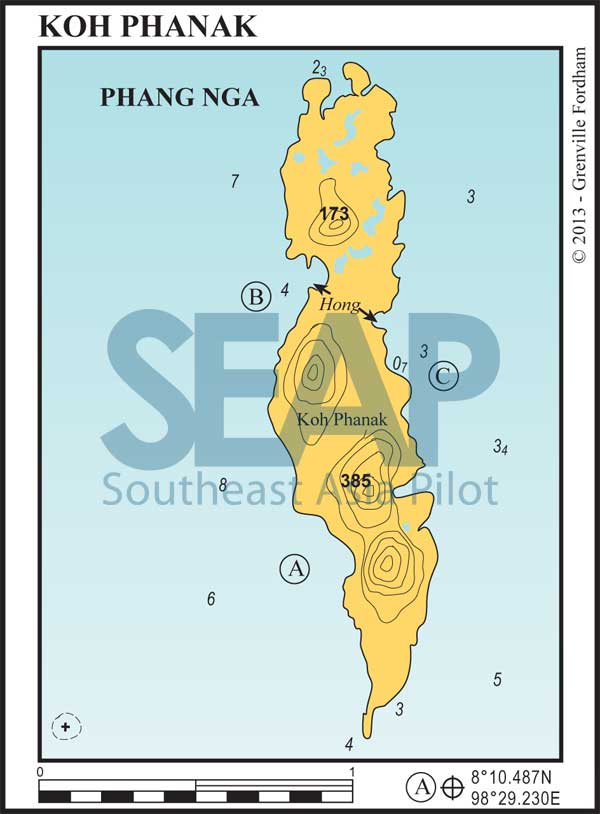
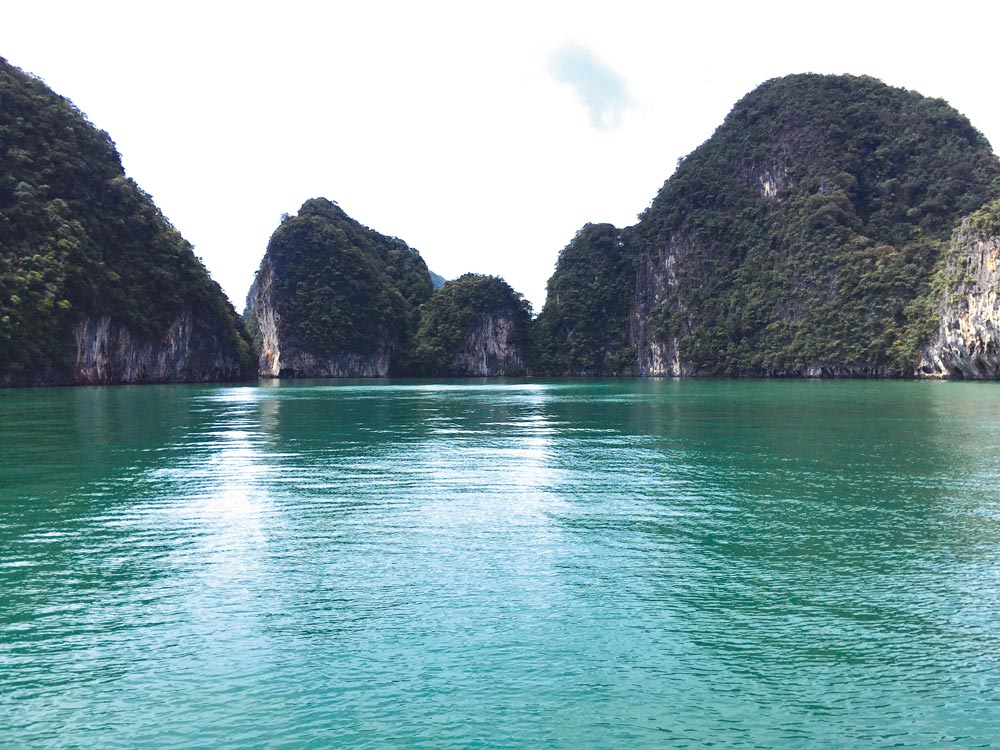
Approaching Koh Phanak from the south, beware of the drying rock one mile to the west of the southern tip. Koh Phanak changes its profile considerably according to the direction of approach, but it has four obvious peaks from the east or west.

12 miles from Yacht haven


A secluded anchorage in approximately 4 metres with good holding on a muddy bottom, the southwest bay is an ideal overnight haven in the northeast monsoon season. There is interesting exploring to be done by dinghy under spectacular limestone overhangs along the entire west coast.
Adjacent to the anchorage, a tide-restricted narrow cave gives access to kayaks at mid-tide for about an hour. If you miss the timing you may have to slither out on your belly in the mud or wait for six hours inside the hong for the next opportunity to escape. Well worth the risk.
14 miles from Yacht haven


The northwest bay also offers good holding in around 5 metres. This is another fine overnight shelter, with the added attraction of many passages and hongs lying hidden inside the island, accessible only by dinghy or canoe at certain states of the tide.
Tourists visit these hongs every day, with many canoes vying to get in and out of the tunnels at the right tide times. If staying overnight you will have quiet access to them (if you can find them) after the tour companies depart. Opposite this anchorage on the mainland is Klong Khean, with an all tide commercial jetty.
14 miles from Yacht haven


This is our recommended overnight stop during the southwest monsoon. Secure holding in mud can be found in approximately 4 metres. Vessels should approach from the east until a comfortable anchoring depth is found. The hong in this location is difficult to access and only at lower than mid-tide.
Click to view Thailand photo gallery.

