Komodo National Park
Southeast Asia Pilot – September 2025
Indonesia’s Komodo National Park: Anchoring Near Dragons and Reefs
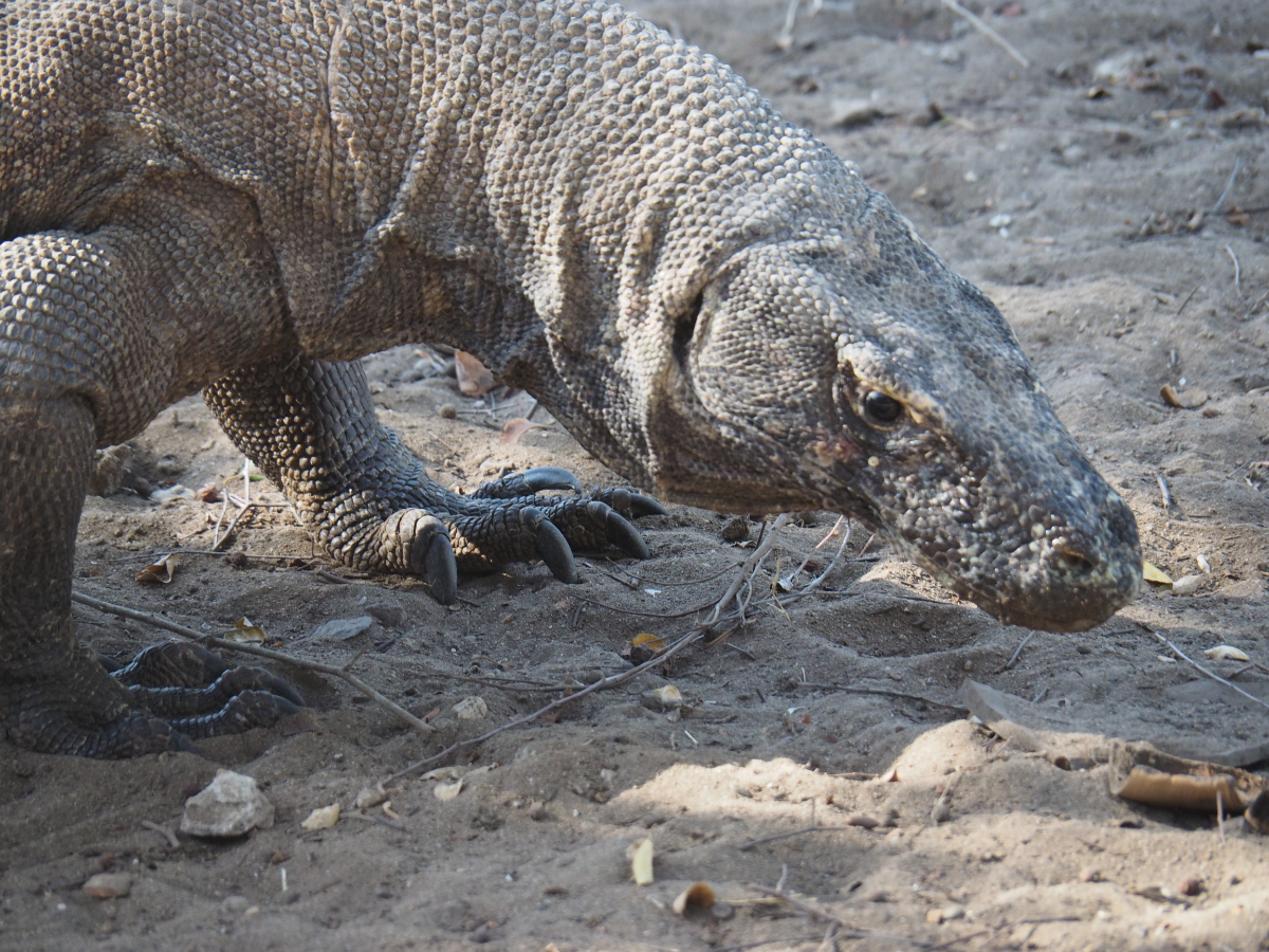
Komodo National Park isn’t just home to the famous Komodo dragons – it also boasts pristine reefs, remote anchorages – and strict entry controls.
⇒ Permits Required: You must obtain national park permits before entry – available in Labuan Bajo.
⇒ Boat Fees and Conservation: Park fees fund rhino and reef conservation – make sure your visit contributes.
⇒ Anchor Smart: Use designated moorings when available. Otherwise anchor on sandy bottom. Anchoring is mostly prohibited and is policed.
⇒ Respect Wildlife: Keep distance from dragons and coral, limit noise and pack out all trash.

KOMODO AND RINCA. 8°34.480S, 119°30.265E
The islands of Komodo and Rinca are the only natural home of the legendary Komodo Dragons. A must-visit when cruising Indonesia. The Komodo group of islands are in the middle of the high-current channels between Flores and Sumbawa. Spectacular steep-sided bays deeply indent Komodo’s south coast. The You’ll find the National Park Head Quarters (Loh Liang) tucked away in the calm sheltered Sora Lia Bay mid-island on the southeast coast. Anchor near the moorings off the two jetties in 10-16 metres on a muddy bottom in front of the Ranger facility.
Report to the rangers
Onshore, report to the ranger station to buy your mandatory national park entrance permits. Guides are also mandatory and charges are levied for each camera in your group. When planning your walks, the longer you hike, the greater potential for seeing dragons. Always carry drinking water and wear good walking shoes.
Many bays
There are many bays in this area, some with moorings (anchoring is mostly prohibited and policed) and some where the fishing, snorkelling and diving are pristine and alive with marine activity. At the southeast point of Sora Lia Bay you will find the world-famous Pink Beach, named because the shoreline consists of crushed red coral branches deposited by an updraft current in the deep channel area nearby.
Patience and kindness
There are many local people on boats here wanting to sell you their wares. They can be overly persistent and we recommend patience and kindness in your potential rejection of their sales techniques.
Rinca Island
Across at Rinca Island is the very protected inlet anchorage of Loh Buaya. It’s right up the end of a narrow yet safe-depth, 250-metre wide mangrove lined waterway. On approaching the entrance, favour port side to keep well clear of the drying bank off the narrowing mouth. Motor the half mile south to 8°39.227S, 119°42.881E and anchor directly in front of the ranger station jetty in 10 metres on sand and mud.
Dragon viewing
This Park Ranger office is where Rinca dragon viewing hikes start and finish. In 2018 it was totally upgraded to handle the increasing traffic of dragon viewers. Rinca dragon viewing is superior to that of the Komodo island experience. There are fewer daily visitors, and more varied and spacious walks, allowing better dragon viewing opportunities. Best to anchor as close as you’re comfortable with and take your dinghy, leaving it tied on the local jetty away from the main traffic areas of local day boats.
For anchorage notes, charts, shoreside tips other useful information, see Southeast Asia Pilot – 7th Edition with detailed coverage of over 600 anchorages across nine countries, from the Andaman Sea to the Spice Islands. Available now in print and digital editions.
⇒ ⇒ ⇒ Order Southeast Asia Pilot
Southeast Asia Pilot and Phuket Publicity Services do their best to ensure that the information on this website is accurate. However, good seamanship demands that seafarers check critical information carefully with relevant sources to ensure it is up to date.FacebookLinkedInInstagram


