Thailand has over 1,000 miles of mainland coastline bordering the Andaman Sea and the Gulf of Thailand. With thousands of islands, there are many more miles of beaches, creeks and headlands meeting the sea. Between 6°N and 13°N, the cruising area’s climate is tropical. Palm trees fringe the pristine white sand beaches. The waters are crystal clear and the coral reefs superb.
Essential stopover for world cruisers
Neither coastline is in a hazardous weather zone; there are no typhoons and even the seasonal monsoons are gentle. Temperatures are 25°-32°C and the sea rarely varies from 28°. Comfortable cruising is possible all year round, even on the Andaman Sea coast, with its strong southwest monsoon breezes. Thai waters have long been an essential stopover for world cruisers; many never leave.
Superyacht charters
16 years ago, showing incredible foresight, the Thai government reduced yacht import duties to zero. They are now discussing with industry leaders how to open Thai waters to superyacht charters. If the outcome is positive, the creati0n of a special superyacht licence will allow foreign flagged yachts over 100ft to charter legally.
However, as this book went to print in March 2024, the process seemed to stall as a result of the intractable ‘chestnuts’: VAT, work permits and visas. Despite this, if the dream ever becomes reality, Thailand – and particularly the Andaman Sea – will become a serious playground for owners of, and those who can afford to charter, the luxurious yachts that make up the top end of the yachting market. Consequently, plans are afoot in several locations to develop marinas and haul-out facilities aimed at the superyacht industry.
Fortunately for your average cruiser, these spectacular yachts are relatively few. Therefore, even when they arrive in their numbers, they will have negligible impact on the islands, beaches and waters of Thailand. Conversely, they will have significant impact on local economies and the availability of quality yacht services.
Effects of mass tourism
In recent years the impact of mass tourism, notably from China – and specifically in the waters around Phuket – has severely affected some of the favourite destinations listed in this guide. This has led to the introduction of a number of new regulations and restrictions to protect the reefs. Restrictions have been placed on the number of tour boats and some island bays have been closed entirely to tour groups and individual yachts.
Some are closed for low seasons only, others for longer, depending on past damage. For example, the National Park Service shut down ‘The Beach’ movie set in Maya Bay on Koh Phi Phi Le before the Covid pandemic; then the dearth of tourists during 2020-2022 allowed the reef and shoreside to regenerate. Sadly, day trip tourists are back in unsupportable numbers so expect the authorities to close Maya Bay again for the 2024 low season. The authors and publisher wholeheartedly support sustainable tourism and welcome all appropriate measures.
Mooring buoys IN – anchors OUT
Many of the anchorages now have proper mooring buoys installed (yellow or red spheres with a blue band). While we can’t guarantee they’re maintained meticulously, they’re always easier and certainly better than anchoring on coral. National Park Ticket collecting speedboats are fast and efficient, collecting entry fees (at time of pubLishing the 7th Edition) of 400 baht per person per entry. They operate during business hours around 10am-4pm. The Marine Department can confirm which bays and beaches are off limits on arrival at check in.
Anchorages in Thailand
>>> Click herefor a complete list of anchorages in Southeast Asia Pilot.LinkedIn
The area bounded by Phuket, Phang Nga and Krabi provinces forms Phang Nga Bay. There are over 100 islands, and the geology varies from low gently sloping mountains to the steep karst outcrops for which the bay is most famous Read more...
National Parks in Phang Nga Bay | Chart by Grenville Fordham
The area bounded by Phuket, Phang Nga and Krabi provinces forms Phang Nga Bay. There are over 100 islands, and the geology varies from low gently sloping mountains to the steep karst outcrops for which the bay is most famous Read more...
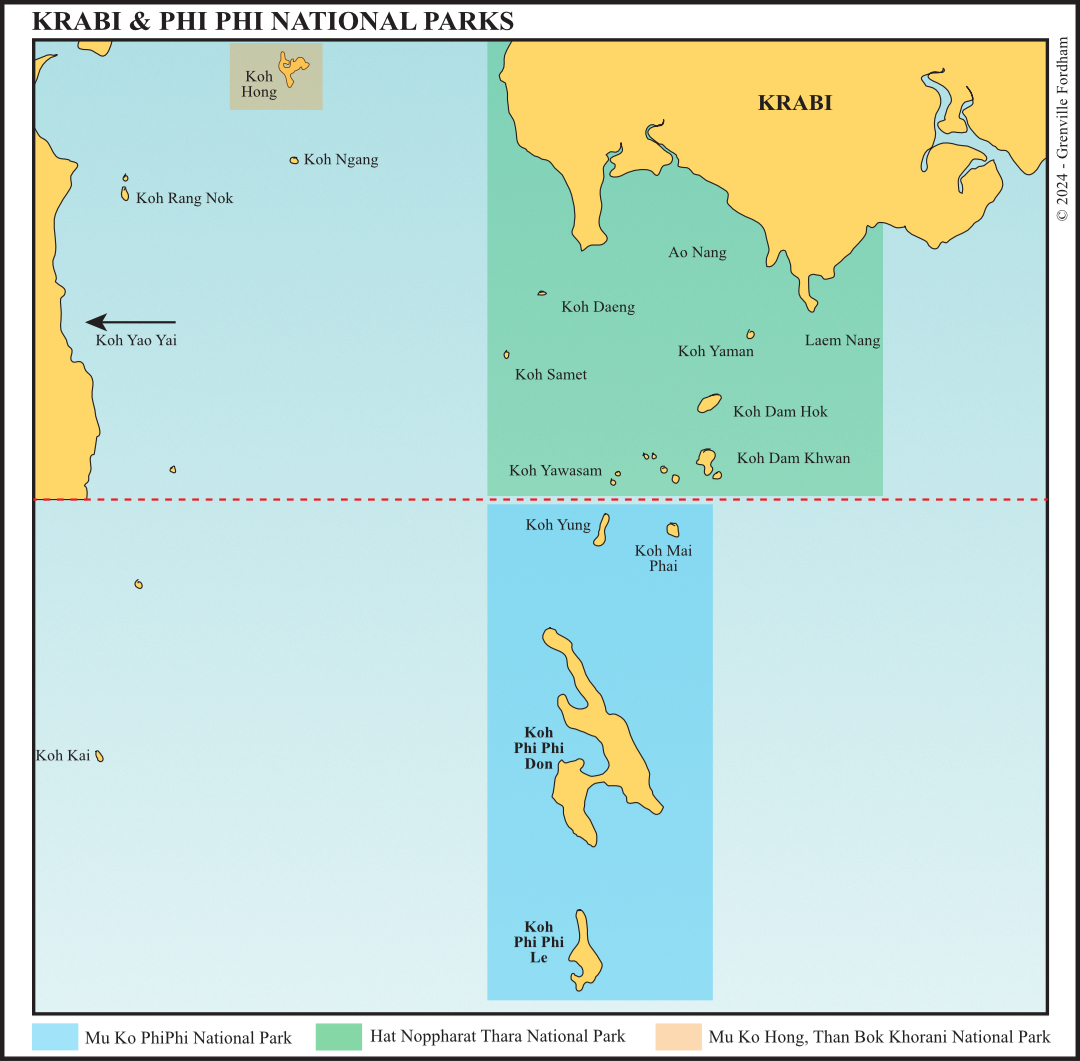
The stunning beach and sea-mountain scenery of Krabi is famous with many visitors extolling some of the beaches here as amongst the most beautiful in the world Read more...
This chapter is focused on the beaches of West Coast Phuket and the coastline between the Sarasin Bridge and Ranong. It covers the two degrees of latitude on the Thai coast from just south of Phuket to the border town of Ranong in the north. Read more...
From Koh Lanta to tarutao covers 110 miles of coastline and islands, encompassing the three mainland provinces of Krabi, Trang and Satun at the Malaysian border. It includes hat Chao Mai National Park, which covers 360 square kilometres and takes in 52 islands... Read more...
North of the Malaysian border, the first main thai ports are Narathiwat and Pattani, both commercial fishing harbours. Not usually on the itinerary of cruising yachts, they can be entered through well-buoyed channels Read more...
Pattaya is 147 km southeast of Bangkok and faces the Gulf of Thailand. the only place of note between Bangkok and Pattaya is a small marina in a housing project in the Bang Pakong River Read more...
Note that this website may not reflect the most recent updates to the printed book and the eBook. While every effort has been made to ensure that the information contained in this book is accurate, the charts of anchorages are based on personal experience and satellite imagery and are intended as a guide only. They should not be used for navigation. Please refer to Official Hydrographic Charts of the respective countries.


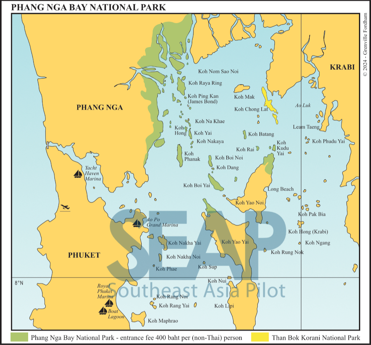 National Parks in Phang Nga Bay | Chart by Grenville Fordham
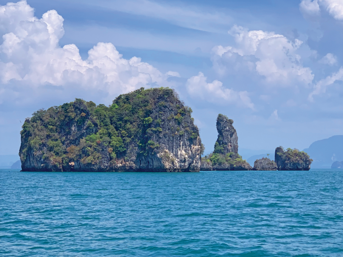
 Railay, Krabi | Photo by Bill O’Leary
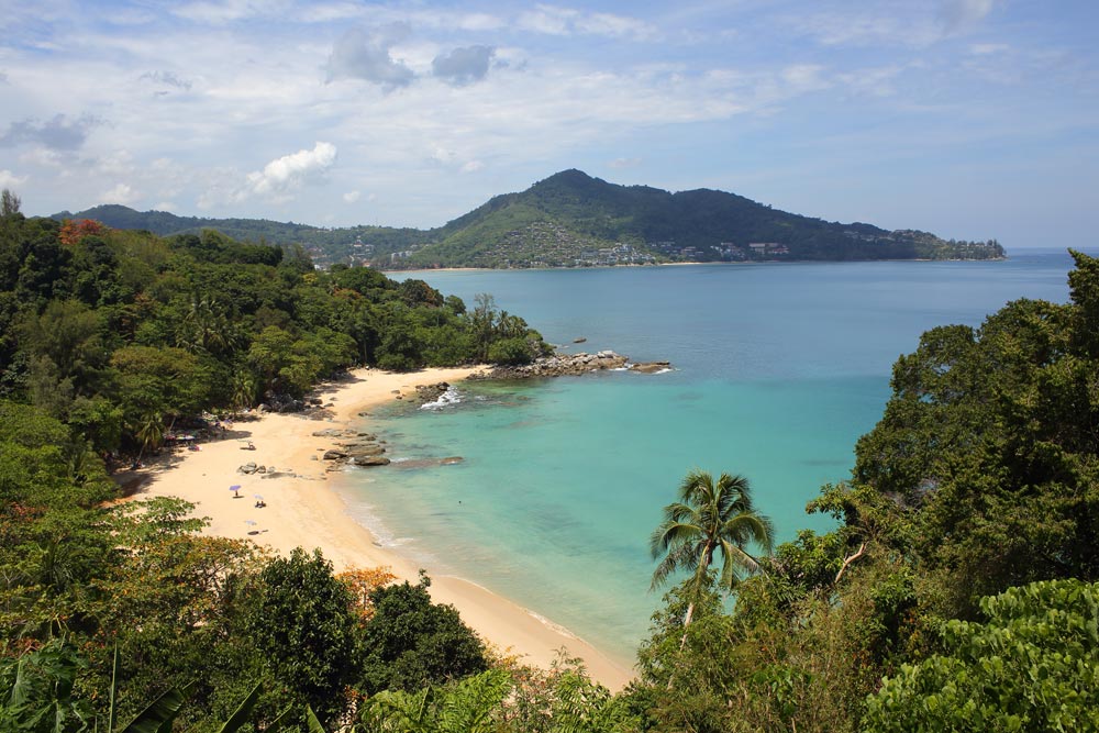 Laem Singh with Kamala in the background | photo by IMAGE asia
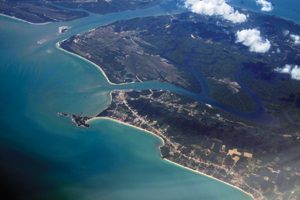 Koh Lanta | Photo by Bill O’Leary
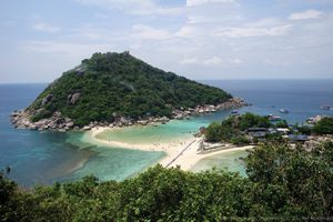 Hang Tao & Nang Yuan | by Klim Levene
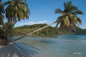 Koh Kut | by Vyacheslav Argenberg