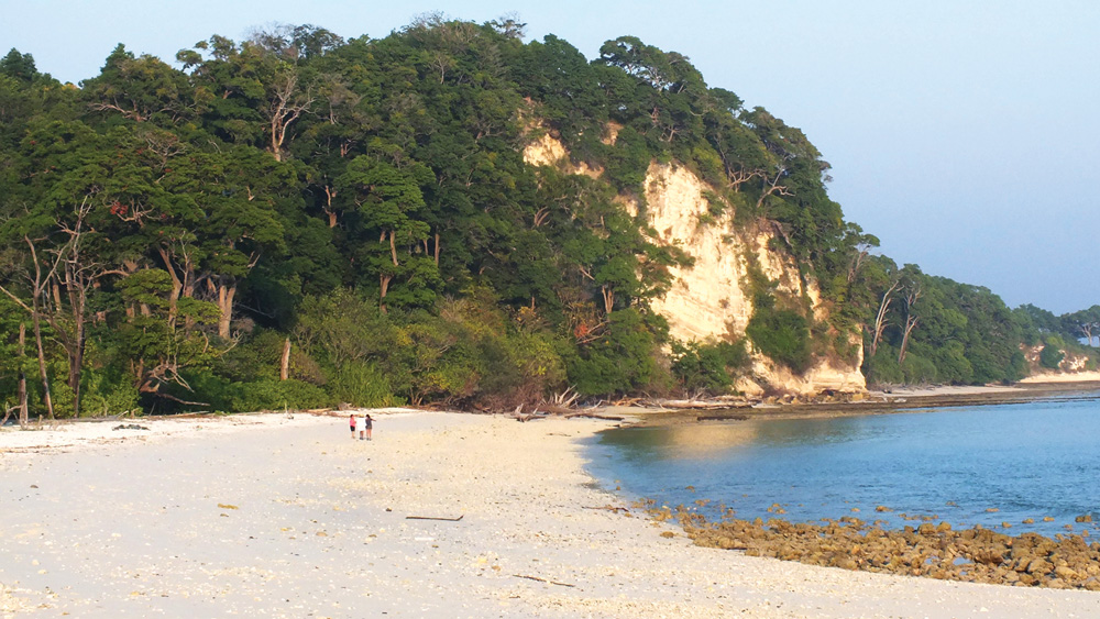
The Button Islands have idyllic deserted beaches and stunning underwater life.
18 miles from Havelock Island


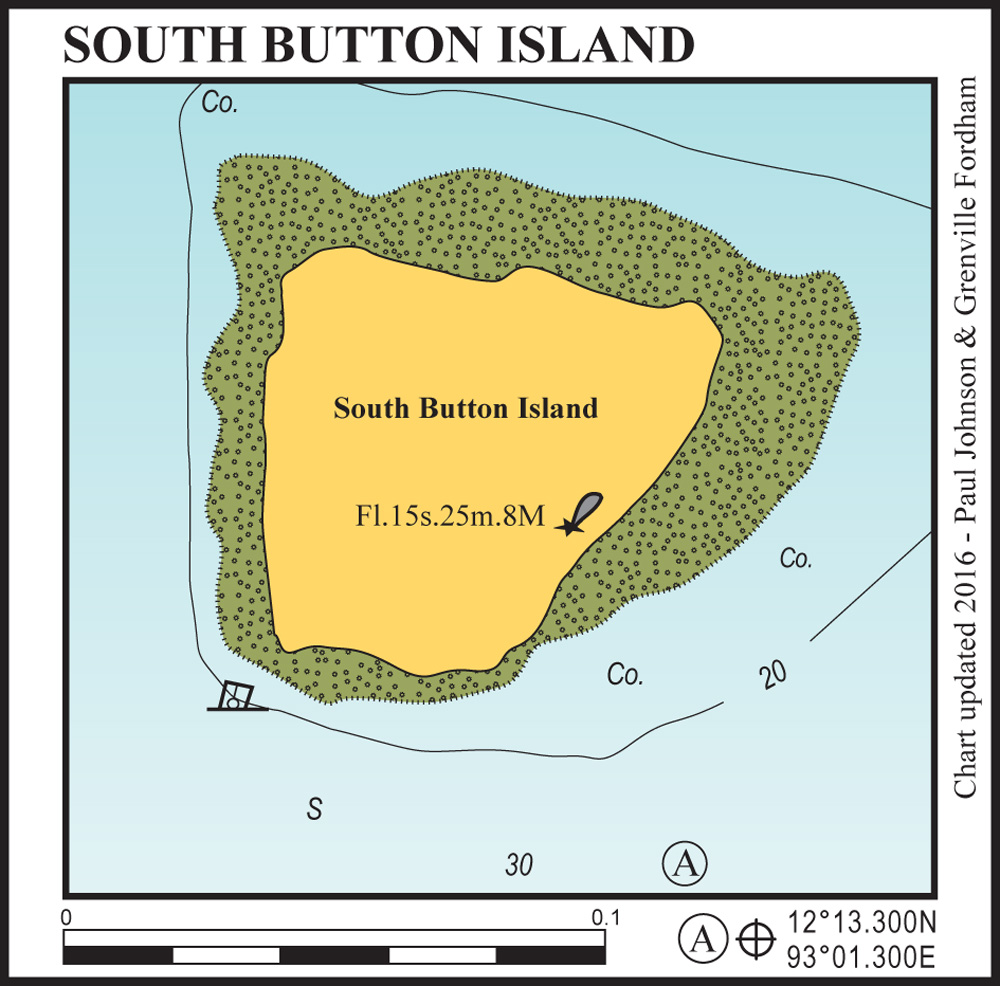
Anchor in 25 metres on sand in the position shown, keeping well clear of the reef edge. There is sometimes a small mooring close to the southern reef edge which is suitable for tying your dinghy up.
Sadly the spectacular coral gardens around this tiny islet were destroyed by high water temperatures during 2011, which killed 99% of the coral. There is still worthwhile diving and snorkelling here, with many juvenile fish clouds and interesting coral bombies in deeper water to the NW side, but it is a shadow of its former glory.
18 miles from havelock island

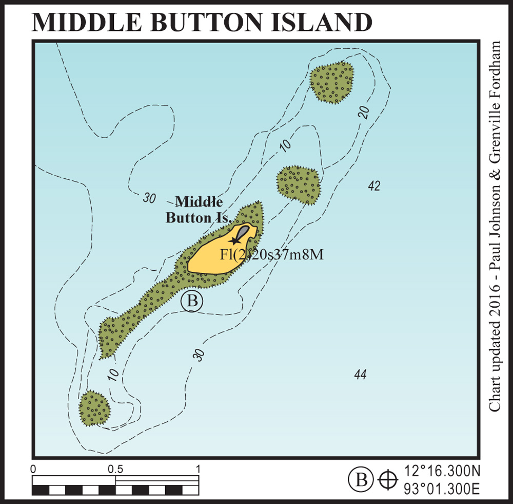
Middle Button has a striking sandy spit off the southwest of the island. Anchor in 12-15 metres on sand avoiding the coral bombies. There is great snorkelling here but, again, the coral in this area has been badly affected by bleaching.
If you go ashore here take your ships papers and approved itinerary with you; the forestry officers who live here will want to see them.
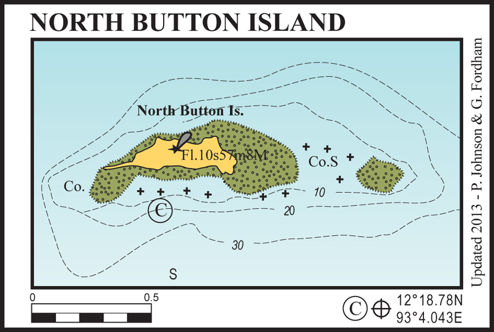
21 miles from havelock island

The horseshoe bay on the southern side provides excellent protection. Anchor in 10-12 metres on a sandy bottom, well clear of the reef. The sand spit at the western end provides all-tide dinghy access to the beach.
This anchorage is easy to enter at night if returning from the volcano islands of Narcondam or Barren. The snorkelling and swimming here are superb with manta rays, dolphins and giant leatherback turtles frequently seen.