
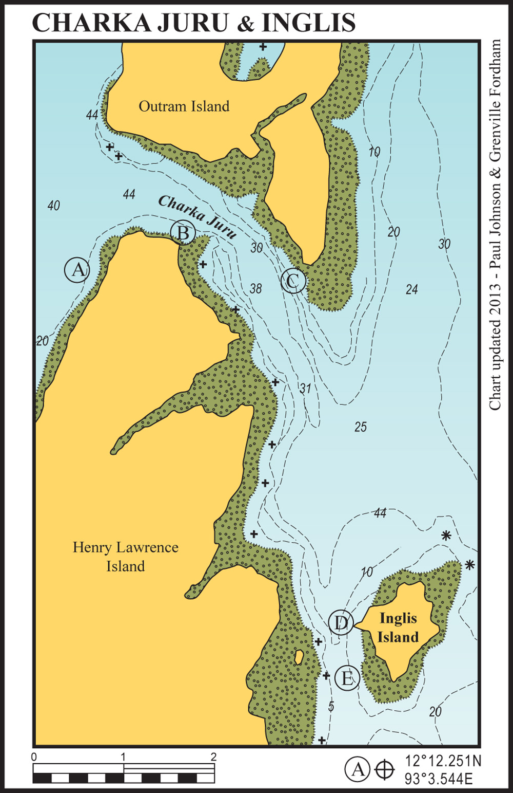
18 miles from laccam harbour


Superb protection in this anchorage, especially at the start and end of the season when the wind can blow strongly from the southeast. Anchor in 20-25 metres clear of the reef edge. The island is inhabited by a single lonely dog that swims out to boats for company or food.
19 miles from Laccam Harbour
Idyllic anchorage in calm weather immediately off the small white beach on Henry Lawrence Island. Approach from the north with care as the reef comes up vertically from 12 metres; anchor in 20 metres and back in slowly.
Great snorkelling along the reef, superb kayaking in the mangrove estuaries to the southeast and a perfect white beach backed by tropical rainforest. This anchorage is not suitable overnight in strong northeasterly conditions.
20 miles from laccam harbour
A well protected anchorage in strong northeasterlies, tucked behind the fringing reef. Anchor in 12 metres on a sand bottom just off the low sandstone cliffs.
Superb fishing along the reef edge with many giant groupers.
It may be possible to surf off this reef during the northeasterlies as there is a substantial left hand break. The reef off the south point of Outram Island extends much further south than is charted.
19 miles from laccam harbour
This magnificent island makes the effort of getting to the Andamans worthwhile. The island is deserted, covered with pristine rainforest and surrounded by white beaches and coral reefs.
Anchor about 200 metres due west of the end of the sand spit in 6-8 metres on a sand bottom. There is all-tide dinghy access on to the sand spit. This anchorage is not suitable in easterly winds of more than 20 knots. The off-lying rocks to the north of Inglis Island do not appear on Admiralty charts.
18 miles from laccam harbour
Anchor in 8 metres on a white sand bottom. The channel between Inglis and Henry Lawrence Island is easily navigable. This anchorage is not suitable in easterly winds of more than 20 knots. Inglis Island is ideal for a walk around but keep an eye open for snakes.


