This website uses cookies to improve your experience. We believe you'll be OK with this, but you can opt-out if you wish. Or you can go to 'cookie settings' and choose which cookies to allow. Privacy policy

Click to view Phang Nga Bay photo gallery.
FacebookLinkedInInstagram9 miles from Boat lagoon


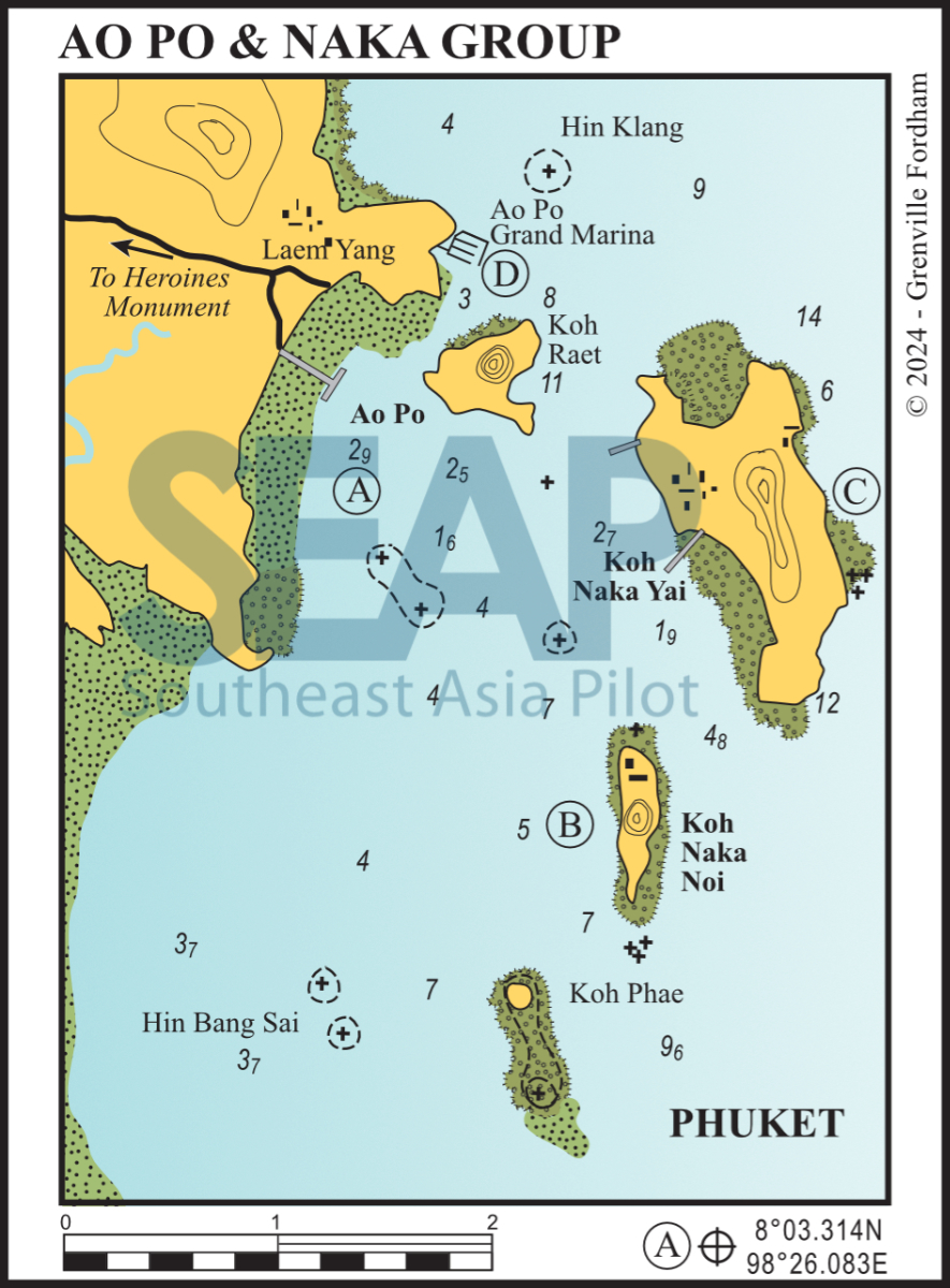
The safest keel-boat approaches from the north use the passages either side of Koh Raet. In the eastern passage, favour Koh Naka Yai until 300 metres south of Koh Raet before turning northwest into the bay. This is to avoid off-lying rocks detached from the main fringing reef on the south of Koh Raet.
In the western passage stay close to Ao Po Marina entrance and follow the markers between the mainland and Koh Raet. Anchor on the muddy bottom in 3-6 metres.
If approaching from the south, stay close to Koh Naka Yai. The three drying rocks marked on the chart definitely exist, and none of these has any navigation markings or buoys.
Some 400 metres long, the jetty is the main departure point for day boats to the Naka Noi Pearl Farm and for most of the sea canoe operators.
A few local-style shops can be found ashore. There is transport to either Phuket City or the airport. Fuel, provisions and ice can be bought in the small village.
Click to view Thailand photo gallery.
FacebookLinkedInInstagram9 miles from Boat lagoon


The best anchorage is in 5-10 metres to the south of the access jetty on the mid-west coast. Keep well clear of the rocks on the north side of Naka Noi if approaching between Naka Yai and Naka Noi. Keep Koh Phae to port if coming from the south.
When heading north from this anchorage, beware of a rock — visible only at very low tides — on the direct line of the passage between Koh Raet and Koh Naka Noi. Once clear of the channel, steer well offshore to avoid a second reef, seldom visible at any tide.
The beach at Nina Beach Camp on the northern tip of the island is great at high tide. There’s a restaurant and bar ashore and water toys for rent.

Click to view Thailand photo gallery.
FacebookLinkedInInstagram11 miles from Boat lagoon


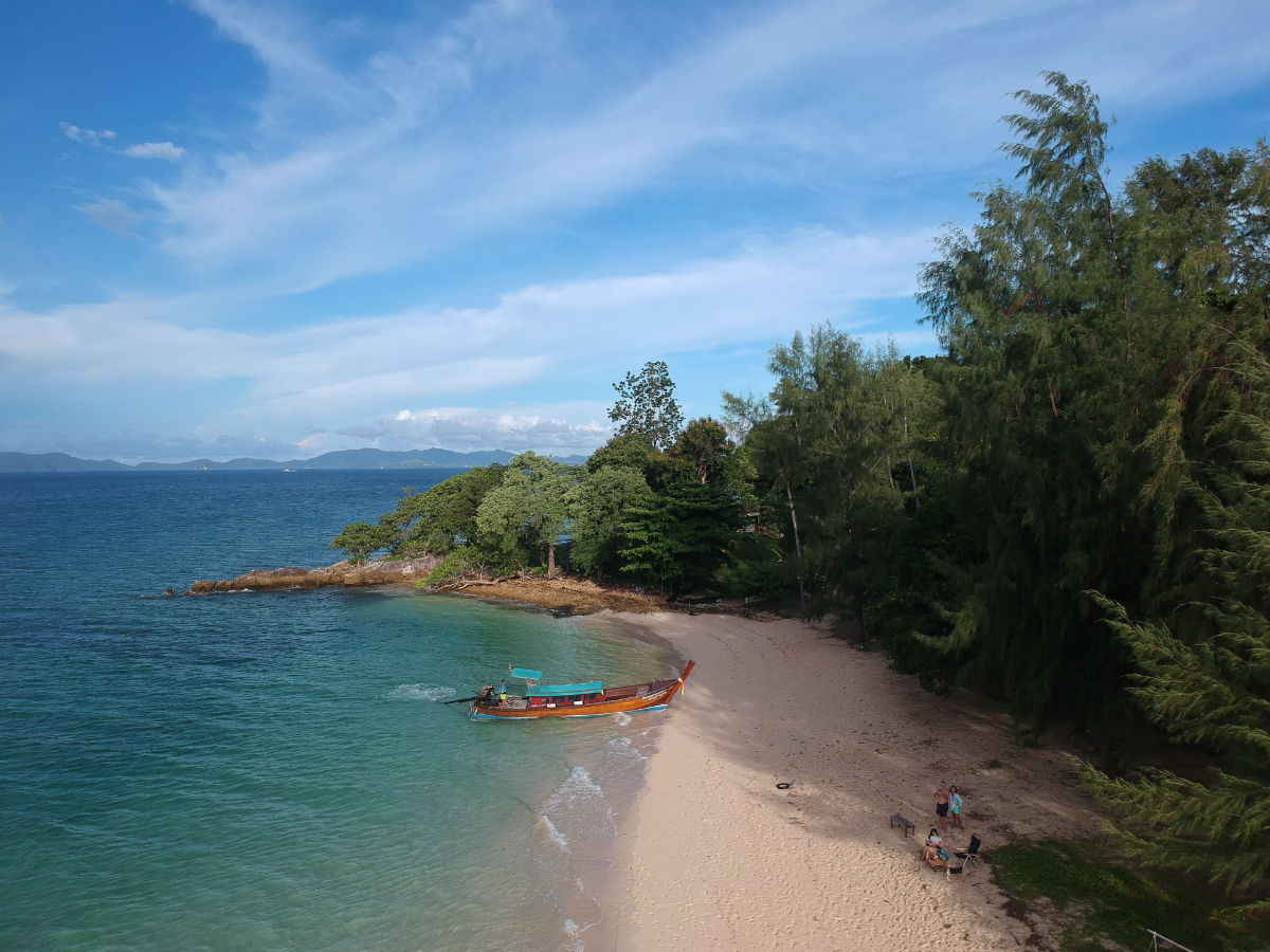
This pretty anchorage in 5-10 metres on a sandy bottom is a suitable overnight stop in either season. On the northeast coast, two beaches divided by a rocky outcrop afford great swimming together with shady coconut groves.
The silica sand middle beach is all-tide, whilst the north and south are accessible only at high tide. Great for exploring but footwear is essential. The middle beach has the best swimming in the North Bay.
There are three floating jetties on these east coast beaches for easy access ashore and numerous F & B outlets.
A favourite daytime stopover for tour boats from Yacht Haven, Ao Po Grand Marina, Royal Phuket Marina and Boat Lagoon. It is the last, early-afternoon, stop on their return from the caves for up to 100 sea canoe clients.
Click to view Thailand photo gallery.
FacebookLinkedInInstagram12 miles from ao Chalong


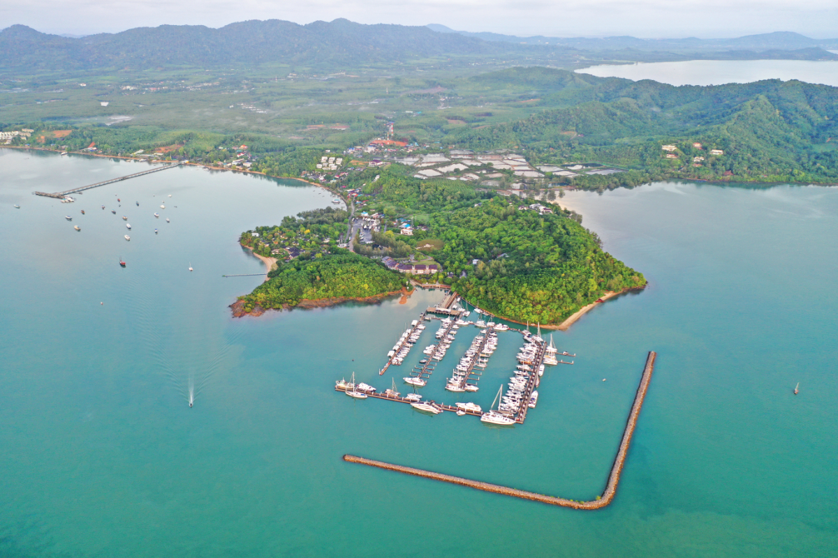
This marina, which has all-tide access, has approximately 230 berths inside a rock breakwater. There are deep water berths for up to 25 superyachts.
The approach is best from the south or east. Yhis is to avoid Hin Klang, the umarked acre of rock awash on the northerly approach. The marina entrance is behind the rock breakwater on the southeast side. Approaching the entrance from the east, stay on 260° (and depart on 80°). This is to avoid the nasty isolated coral head ‘bombies’ off Naka Yai’s north fringing reef.
Some of Phuket’s yachting businesses make this marina their main base of operations due to the proximity of the cruising grounds of Phang Nga Bay. Onshore are a restaurant, a bar, a slipway and hardstand.

