This website uses cookies to improve your experience. We believe you'll be OK with this, but you can opt-out if you wish. Or you can go to 'cookie settings' and choose which cookies to allow. Privacy policy

Laem Nang is the headland where you’ll find three great anchorages: Rai Lei Beach, Tonsai Beach and Phra Nang Beach.

FacebookLinkedInInstagram
Click to view Krabi & Phi Phi photo gallery
1 mile from Ao Nang, Krabi


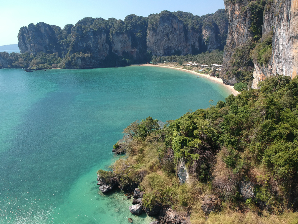
Anchorage at Rai Lei Beach is in 4-5 metres on sand in the centre of the bay. This bay has spectacular stacks of rock forming headlands to the north and south.
In the shade of the coconut palms fringing the beach, restaurants and bungalows tend to be frequented by educated budget travellers. This contributes to the easygoing ambiance. Some comfortable private houses, with a bar frequented by local expats, are set back from the north end of the beach. There are houses here for rent on a daily basis.

A reef, easily seen in the clear waters and a magnet for snorkellers, extends into the bay at the southern end of the beach. Walk along the headland at low tide, and find several caves, fissures and spectacular overhangs. Going to the right on the beach, there are longtail boats for hire; there is no road access to this area due to the enclosing rock walls.
Click to view Thailand photo gallery.FacebookLinkedInInstagram
1.5 miles from Ao Nang, Krabi


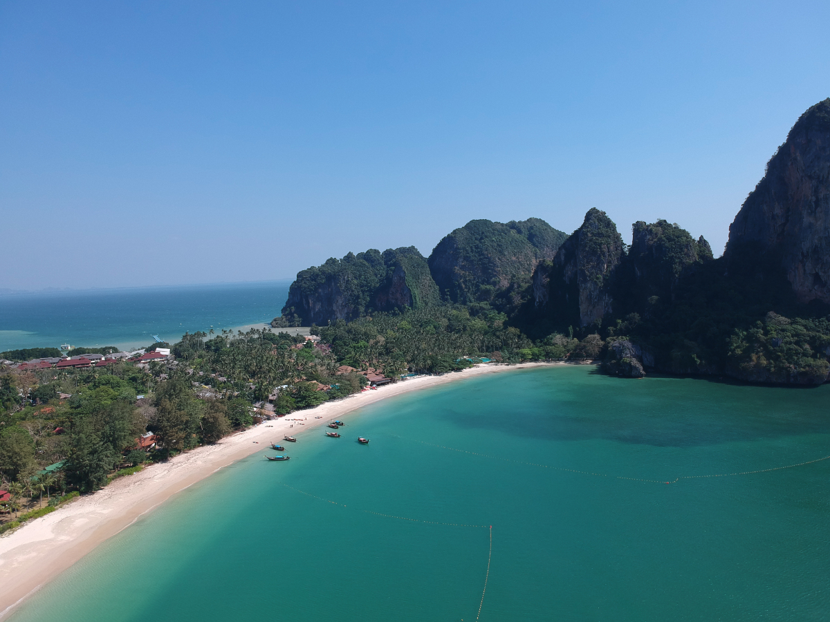
Hat Phra Nang, the most strikingly attractive palm-fringed bay in the region, is just around the corner from the tall stack which forms Koh Nang. In the northeast monsoon season, anchorage with reasonable swinging room is possible for three or four vessels in 5-6 metres on a sandy bottom.
Between Koh Nang and the beach is a colourful coral reef, excellent for snorkelling. This passage is definitely impassable for keel-boats, and even for dinghies it’s advisable only at high water. It’s best to ignore whatever the activities of the local longtail boats might seem to suggest.

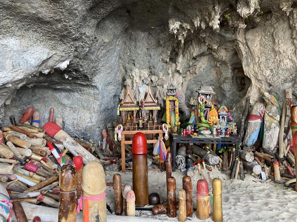
The famous ‘Princess Cave’ (Hat Tham Phra Nang), with a colourful phallic shrine inside, is at the south end of the beach. Lots of rocky overhangs and outcrops make for great exploring. Behind the beach lies the Rayavadee Resort in a spectacular coconut-grove setting. The hotel facilities are for guests only. There is no access by road.
On the path from East Rai Lei to Tham Phra Nang is the track to the Pool Cave. Although there are ropes to assist with the almost vertical climb, this is not for the faint-hearted or the unfit.
Sport rock climbing has been thriving here on the steep-sided limestone pillars. Tour companies based in East Rai Lei on the other side of the Laem Nang headland or in Ao Nang can arrange equipment and guides as well as climbing tuition.
Click to view Thailand photo gallery.FacebookLinkedInInstagram
3 miles from Ao Nang, Krabi


The East Rai Lei anchorage provides reasonable shelter, particularly during wind or swells from the west. It is the one the supply boats that service the hotels and bungalows on the rock-enclosed peninsula use. The hordes of noisy island day trip long tail boats share the facility.
About 2.5 miles to the northeast, past Ao Nam Mao, you’ll find the famous fossil shell beach. It is known locally as the Su San Hoi and has huge slabs that look like concrete embedded with 75-million-year-old shells.
For shore access tie your dinghy toward the seaward end of the long floating pontoon. Watch your step on this pontoon; wear appropriate footwear and bring a torch if going ashore after dark. There is a paved road joining the bays. This gives access to the middle ground, now a mish-mash of supermarkets, restaurants and lively bars. From the pontoon base, turn right then next left for the quickest path to Rai Lei’s ‘Sunset Beach’. Click to view Thailand photo gallery.FacebookLinkedInInstagram
