SEAP Southeast Asia Pilot-1
  >   Thailand   >   Phang Nga Bay

KOH NOK

  • E

KOH NOK

25 miles from Yacht haven

KOH NOK. 8° 4.669N, 98° 37.422E

Tucked in behind the neighbouring small islets and rocks, this spot offers limited protection in the northeast monsoon season.

To the west, a sandy spit runs out in shallow water towards some rocks. Excellent as a stopover on the way to the Koh Hong island group or Krabi, this beach is good for swimming, but the current can be strong at the third hour of the outgoing tide.

The steep path up to the top of the island has a sturdy rope to make the near vertical climb safer.

Click to view Thailand photo gallery.
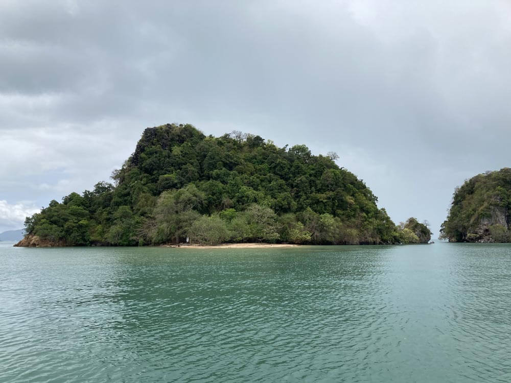
Koh Nok, Phang Nga Bay, Thailand | Photo by Grenville Fordham

Chong Koh Yao

Chong Koh Yao is the passage between the Yao Islands, used extensively by local vessels en route to Phuket from the northeast of Koh Yao and the Krabi area. For pleasure vessels, even keelboats, it’s navigable with care on a mid- to rising tide. Rule of thumb: the high tide must be at least 0.5 metres more than your vessel’s draft.

The approach from the west is to favour the north coast of Koh Yao Yai heading towards the fixed white tower marker at 8°05.10N, 98°34.55E, then steer 65°towards the seaward end of the commercial jetty on Koh Yao Noi, before passing north of the visible rock. Once clear steer southeast to exit the channel.

A ferry service leaves several times daily from the jetty on Koh Yao Noi, landing on Phuket at the inlet called Bang Rong just south of Ao Po.

Rocks in the channel

These rocks are visible at all tides and are clearly marked with an isolated danger beacon. Used as a navigation aid transiting Chong Koh Yao, keel vessels should always pass well clear to the north.
  Go to top

While every effort has been made to ensure that the information contained in this book is accurate, the charts of anchorages are based on personal experience and satellite imagery and are intended as a guide only. They should not be used for navigation. Please refer to Official Hydrographic Charts of the respective countries.

Copyright.
The copyright holders of all content, in print and digital editions, are: Published book © Phuket Publicity Services Ltd. Part. / Texts © Bill O’Leary, Andy Dowden & Grenville Fordham / Design, layout & charts © Grenville Fordham / Photography: © as indicated in photo credits. All rights reserved
No part of this publication may be reproduced, stored, or transmitted in any form or by any means - graphic, electronic or mechanical, including photocopying, recording or otherwise – without the express permission of the publisher, Phuket Publicity Services Limited Partnership, and the other copyright owners.

Phuket Publicity Services Partnership, Ltd.,
Phuket Publicity Services Partnership, Ltd.,19/87 Moo 7,T.Srisunthorn, A. Talang, Phuket 83110 Thailand
Privacy policy