This website uses cookies to improve your experience. We believe you'll be OK with this, but you can opt-out if you wish. Or you can go to 'cookie settings' and choose which cookies to allow. Privacy policy

131 miles from Patong Bay


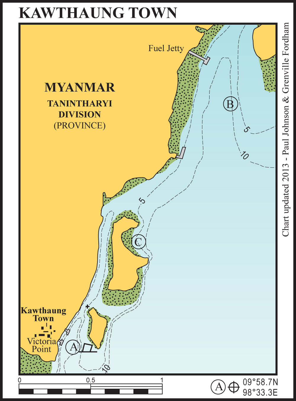
Approach from the south staying close to Victoria Point. Anchor in 4-8 metres in thick mud between the main Kawthaung town jetty and Mwe (Browning) Island). On arrival, contact MTT to assist with checking in. The MTT office is on the southern end of the waterfront.
This anchorage is well protected and is out of the main flow of current that thunders past at 2-3 knots further out.
There is, however, significant risk of collision with drifting boats in this anchorage, a permanent racket from longtail boats and, at night, there are large, hungry mosquitoes. It is recommended to use this anchorage during the day and to move to either anchorage (B) or (C) overnight. Let MTT know where you are going if you do move.
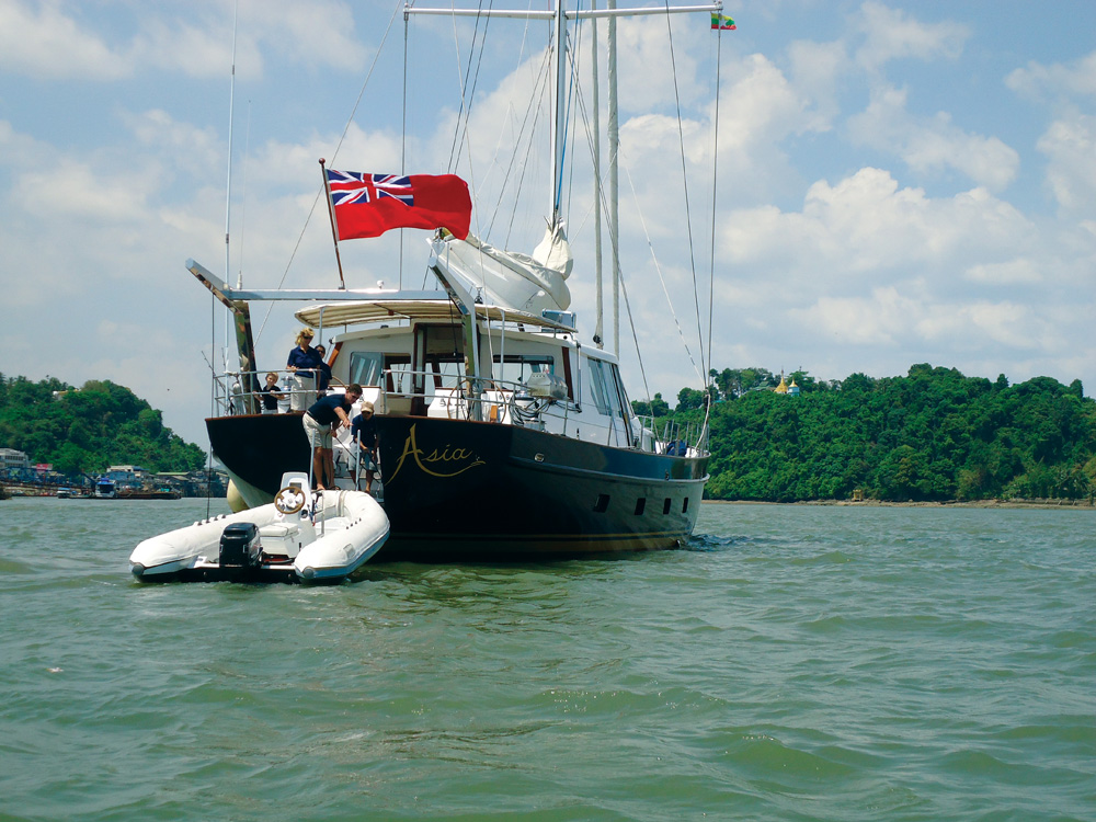
If you choose to stay in the town anchorage overnight it is a good idea to fender both sides of the yacht and to leave lots of lights on. Dinghies can be safely left at the town jetty or there is a water taxi service available from dawn until about 21:00 at night.
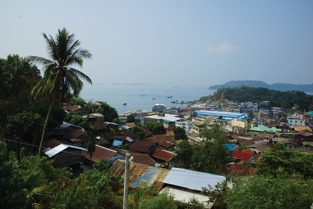
Kawthaung is a fascinating town, particularly if you take the time to explore. The Buddhist monastery on the hill at the northern end of town is particularly worth a visit with impressive guardian dragons and great views over Kawthaung.
Kawthaung has a variety of good restaurants and bars along the waterfront and up the hill behind the clock tower. The Honey Bear Hotel on the waterfront offers air-conditioned accommodation and is so proud of its two large generators, it has them arranged as a showpiece either side of the foyer.
2 miles from Kawthaung
The best overnight anchorage while in Kawthaung. Anchor in 5-8 metres to the eastern side of the channel between Pulau Nyor and the mainland. This anchorage is perfectly protected and has excellent holding in thick, black mud. The large concrete jetty ashore has good diesel, fresh water and cooling ice. Approach the southern side of the jetty for diesel. Payment is in Thai baht.
1 mile from Kawthaung
A good overnight anchorage while in Kawthaung. anchor just inside the bay in 6 metres just outside of the main current flow.