260 miles from Kupang


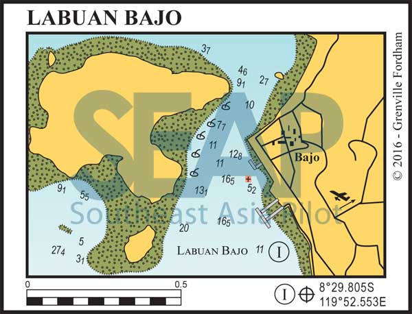
Approaching from the south on NW heading running past the small river on starboard to find a good spot about 250 metres south of the square concrete commercial jetty. Anchor here in 12-14 meters on sand. The northern channel is narrower (but still safe), so more attention is required. There are strong currents running through the channel between town and Bajo Island and when wind and tide oppose it gets interesting.

To describe Labuan Bajo Anchorage as chaos is an understatement, with hundreds of boats of all shapes and sizes accessing and using this area. Unless you have something specific to do in Labuan Bajo it is only a stop-and-go location.
Once at anchor, dinghy in just past the north wall of the commercial pier where a restaurant owner has a private dock you can readily use without charge. The Harbour Master’s office and town amenities are a short walk. Since late 2018 there is cement floating pontoon and public small craft jetty just south of the water front market. As with anything in Labuan Bajo, take great caution as all level of small craft are zipping in and around these areas.
Labuan Bajo is the closest populated settlement to Komodo with flight connections to other Indonesian destinations. Many tour operators and local charter boats use it as the pickup point for their Komodo and Rinca Island excursions.
This once-quaint waterfront town has fast developed into the next hyper-growth tourist area east of Bali and the Gilis, with facilities for cruising yachts. Unfortunately marine operations support has not kept up with this growth. Nevertheless, on a relatively primitive scale anything and everything a cruising yacht needs is available – with access to small repairs, fuel, water and local provisions. Anything with any level of sophistication, including first-world provisions, has to be flown in from from Bali.
Labaun Bajo has a cosmopolitan range and quality of restaurants and eating-houses. It is a livewire of activity for diving and snorkelling tours and has some interesting overland excursions to unique villages in the mountains behind the town.
Click to view Indonesia photo gallery.
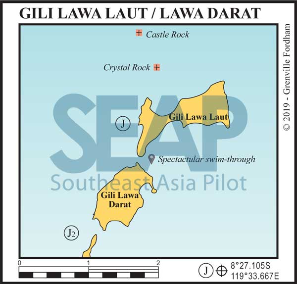
If coming from the east you need to round the northern tip Gili Lawa Laut itself, keeping a medium distance off but not wide enough to bring hitting Crystal Rock on your port side into play.
Castle Rock is further to the north of Crystal in between Crystal Rock and the small rocky island of Tokotoko.
Crystal Rock 8° 26.384S, 119° 34.010E
Castle Rock 8° 25.871S, 119° 33.738E
Once through the passage between Gili Lawa Laut and Crystal rock, on a southern course, yachts can find comfortable 30-40 metre anchorages with two options.

