750 miles from Bitung


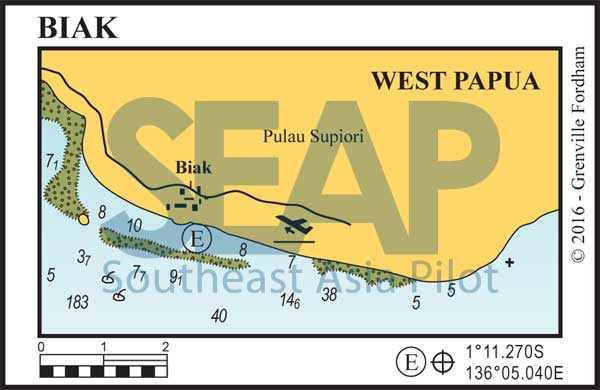
Biak is the gateway port to the beautiful Chandrawasih Bay. A wonderful cruising location even though a deep Pacific swell from the northeast can sometimes make it a bit uncomfortable.
Do not rely on navigation beacons or the harbour lights functioning. Approaches to the harbour from the south through the fringing atolls are open and clear but best timed for daylight hours. Follow the leads through the reef opening and run west parallel to the coast for a mile to anchor on the 9-12 metres on sand and broken coral off the small jetty just outside the Instsia Biak Beach.
Full check in facilities are rustic and not much English is spoken. A few local markets have exceptional seafood and the main commercial dock to the west supplies fuel by the drum. There are a few low-end local hotels and restaurants, banks and shops.
The airport is 15 minutes from the harbour with public transport easily accessible. Daily, but inconsistently timed, flights head west to all the main towns or east to Jayapura. Bookings can be difficult because airline computer ticketing systems rarely function.
There is a WWII aircraft wreck dive in 20 metres just outside the barrier reef at 1°11.300S, 136°03.530E and local dive guides are happy to arrange everything at a small fee.
Biak is close to the beautiful and secluded reefs and beaches of the Padaidori islands some 20 miles southeast. These dozen islands are well worth a long visit, especially for diving enthusiasts. Our choice is to shelter inside the Woendi Island lagoon just off the village supply pier in 8-13 metres on sand at 1°15.360S, 136°22.672E. This remote and unspoiled fishing village is truly special and it’s easy to catch the daily supply boat back to Biak to restock supplies.
