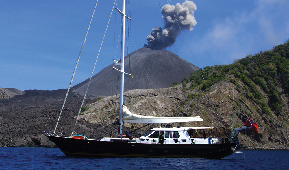
Barren Island is a spectacular active volcano that last erupted during the earthquake that caused the 2004 tsunami. It is less active now than in recent years, but still occasionally throws volcanic ash into the air. Shore visits are not permitted.
Anchoring is difficult as the island is surrounded by near vertical, vertigo-inspiring dropoffs to over 1,000 metres, which makes the diving incredible.
Underwater the landscape is even more spectacular than above, with live coral set against a black volcanic ash backdrop. There are lots of large pelagics and big sharks. Fishing is superb but you often catch half a fish because something else eats it as you’re trying to wind it in.
47 miles from North Button


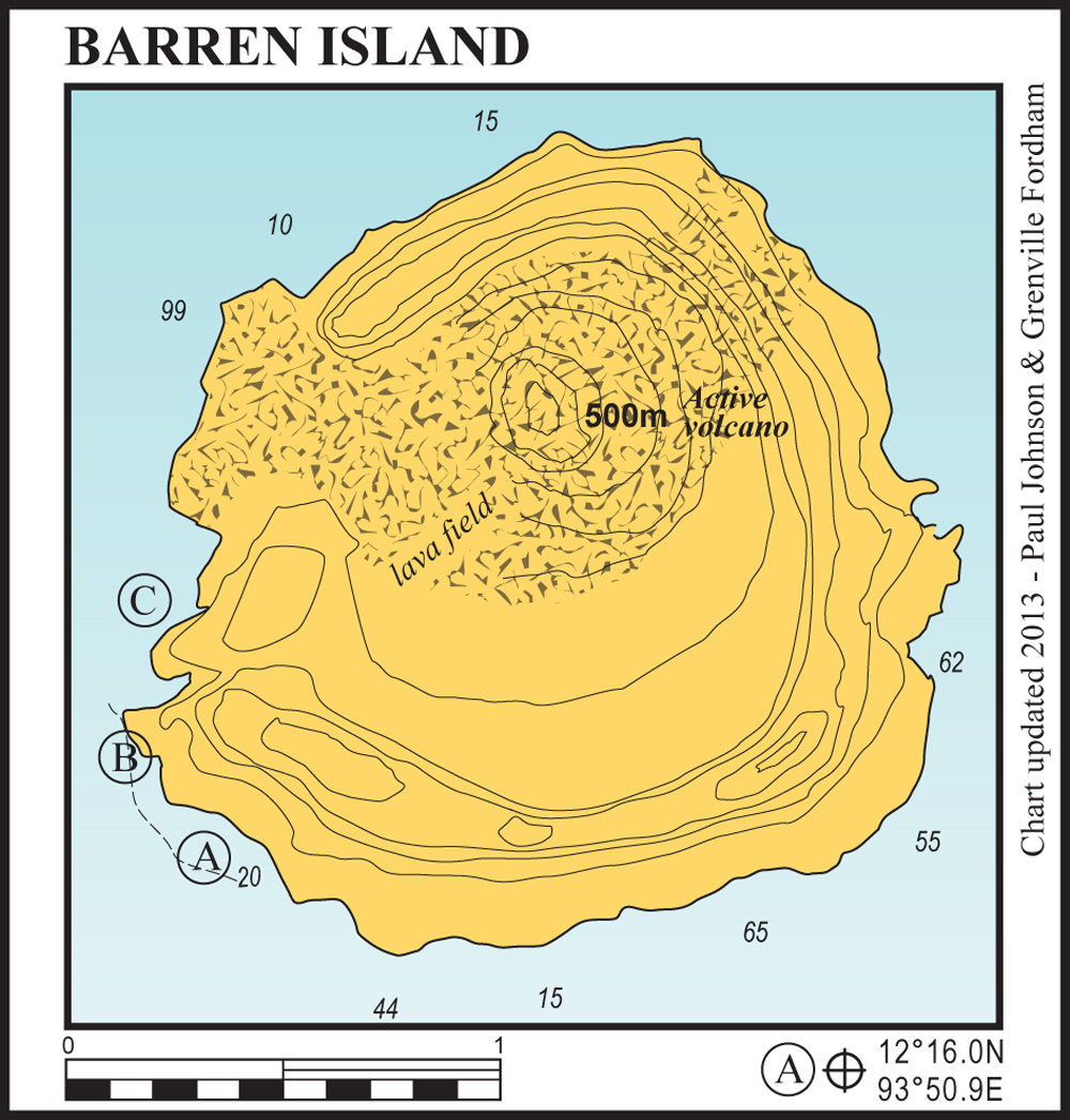
A shallow shelf sticks out from the small, black volcanic beach ashore. In shallower water there are coral bombies. Anchor on the outer edge of this shelf in 20 metres on volcanic sand. If the volcano is active you will have a steady stream of volcanic grit landing on you. This anchorage also suffers from groundswell in strong northeasterlies.
47 miles from North Button
This is an unlikely looking, but good and easy, anchorage if conditions are calm. Get as close to the point as possible and anchor in 10 metres on black volcanic sand. The bottom slopes away gradually to 15 metres and there is then a wall that vanishes into the depths.
47 miles from North Button
This is undoubtedly the most spectacular anchorage at Barren Island. Common sense dictates you should have a long hard look at the volcano before anchoring here at the bottom of the lava flow.
You will need a good bow and stern anchor. Basically you want to end up strung across the mouth of the small inner bay formed by the lava flow with a bow anchor on the shelf on one side, a stern anchor on the shelf on the other side and the yacht sat between these in deep water. This spot is exceptionally well protected and is out of the volcanic dust fallout.