SEAP Southeast Asia Pilot-1

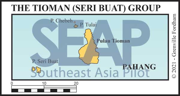
The Tioman (Seri Buat) Group

The Tioman and Seri Buat Island Group chart
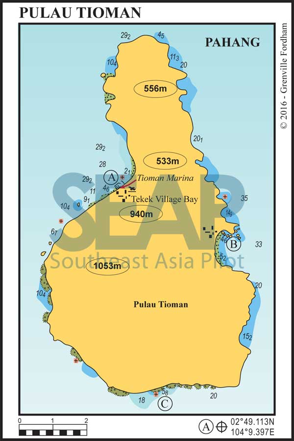
Tioman Island chart
  • A

TEKOK TEKEK (TIOMAN MARINA)

120 miles from Singapore

TEKOK TEKEK (TIOMAN MARINA). 2°49.113N, 104°9.397E

Best to approach the bay in daylight hours as the fringing reef rises rapidly from 20 metres. Anchorage is possible off the reef along the entire length of the bay in 12 metres or more on a rocky bottom.

Next to the ferry terminal jetty, behind a long rock wall breakwater, is the marina at Teluk Tekek village. The construction was highly controversial on environmental grounds, but is certainly a welcome facility for yachts visiting the island. However, there are only 50 berths and you’ll be lucky to get onto the visitors’ dock.

Read more

Click to view Malaysia photo gallery.

  • B

TELOK JUARA (TIOMAN)

14 miles from Tioman Marina

TELOK JUARA. 2°47.39N, 104°12.22E

This east coast resort bay, with two sand beaches, provides excellent protection in the southwest monsoon Anchor in 10 metres on a sandy bottom off the northern beach jetty at the Juara Bay Resort.

There is a small community village ashore and several small resorts where limited provisions are available.

Read more

Click to view Malaysia photo gallery.

  • C

MUKUT VILLAGE

12 miles from Tioman Marina

MUKUT VILLAGE (STH TIOMAN). 2°43.129N, 104°11.688E

Anchor in 8-15 metres on sand in front of the village. Mukut is the small friendly kampong fishing village on this southern coast of Tioman. There are a number of small bays and basic resorts scattered along this coast.

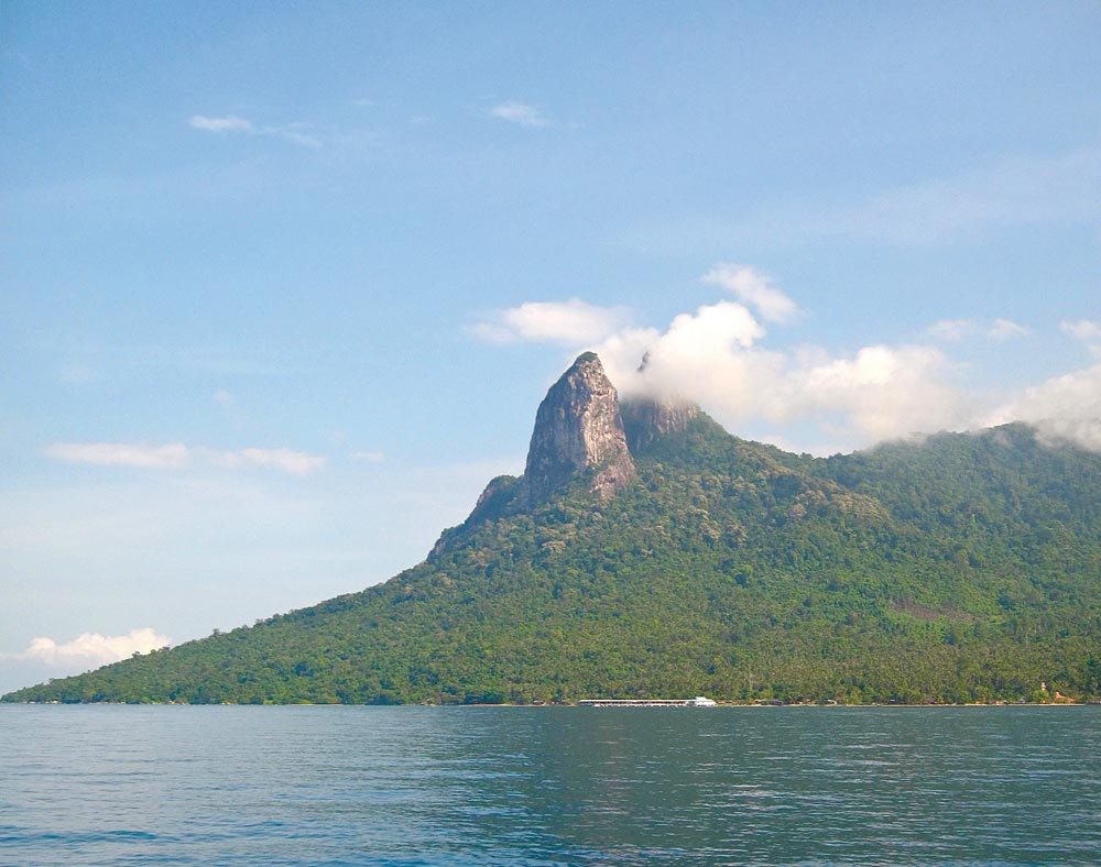
The scenery is impressive, with the distinctive twin peaks ‘Donkey’s Ears’ or ‘Dragon Horns’ of Gunung Semukut towering above. This is one of Malaysia’s most sought-after rock climbing destinations.

Read more

Click to view Malaysia photo gallery.

Donkey’s Ears or Dragon Horns of Gunung Semukut
The distinctive ‘Donkey’s Ears’ or ‘Dragon Horns’ of Gunung Semukut | Photo by Bill O’Leary

See also:

  Go to top

While every effort has been made to ensure that the information contained in this book is accurate, the charts of anchorages are based on personal experience and satellite imagery and are intended as a guide only. They should not be used for navigation. Please refer to Official Hydrographic Charts of the respective countries.

Copyright.
The copyright holders of all content, in print and digital editions, are: Published book © Phuket Publicity Services Ltd. Part. / Texts © Bill O’Leary, Andy Dowden & Grenville Fordham / Design, layout & charts © Grenville Fordham / Photography: © as indicated in photo credits. All rights reserved
No part of this publication may be reproduced, stored, or transmitted in any form or by any means - graphic, electronic or mechanical, including photocopying, recording or otherwise – without the express permission of the publisher, Phuket Publicity Services Limited Partnership, and the other copyright owners.

Phuket Publicity Services Partnership, Ltd.,
Phuket Publicity Services Partnership, Ltd.,19/87 Moo 7,T.Srisunthorn, A. Talang, Phuket 83110 Thailand
Privacy policy