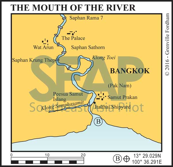

Pak Nam, or the ‘Mouth of the Water’, is the area from the Samut Prakan to the sea. The channel starts six miles south of the mouth of the river leading up to Pak Nam, and is clearly marked by 40 green and red buoys. The channel is 7 metres deep and is commonly used by ocean-going cargo ships as well as by smaller local boats and barges. Currents are significant, especially the south-setting flow during ebbing tides.
Read moreA network of Klongs (canals) links the rivers and waterways of Pak Nam. Longtail and express boats are available to take you to Bangkok (1 hour) or to Samut Sakorn, 30 kilometres west on the River Tha Chin. The klongs can be explored by dinghy, but beware of floating plastic bags and obstacles. Bring a spare pin for your outboard motor propeller.
Samut Prakan is a port of entry for Thailand. The anchorage for customs and immigration lies west of the northern point of Peesua Samut Island. Tie your dinghy up to any of the several small jetties. A typical Thai Town, Samut Prakan has a busy central market where basic food and supplies and mechanical shops are available (and where only Thai is spoken).
Bangkok is 25 kilometres, or a half-hour away by road, traffic permitting. Fuel is available from several jetties situated on the east side of the river. Water and fuel are available at three jetties on the west bank, north of the entrance of Khlong Samphasamit, and near Khlong Tari east of Buoy #34. Though the chart indicates very shallow banks, sea-going tug boats and fishermen refuel here.
Note that this website may not reflect the most recent updates to the printed book and the eBook. While every effort has been made to ensure that the information contained in this book is accurate, the charts of anchorages are based on personal experience and satellite imagery and are intended as a guide only. They should not be used for navigation. Please refer to Official Hydrographic Charts of the respective countries.
Copyright.
The copyright holders of all content, in print and digital editions, are: Published book © Phuket Publicity Services Ltd. Part. / Texts © Bill O’Leary & Grenville Fordham / Design, layout & charts © Grenville Fordham / Photography: © as indicated in photo credits. All rights reserved
No part of this publication may be reproduced, stored, or transmitted in any form or by any means - graphic, electronic or mechanical, including photocopying, recording or otherwise – without the express permission of the publisher, Phuket Publicity Services Limited Partnership, and the other copyright owners.


This website uses cookies to improve your experience. We believe you'll be OK with this, but you can opt-out if you wish. Or you can go to 'cookie settings' and choose which cookies to allow. Privacy policy
