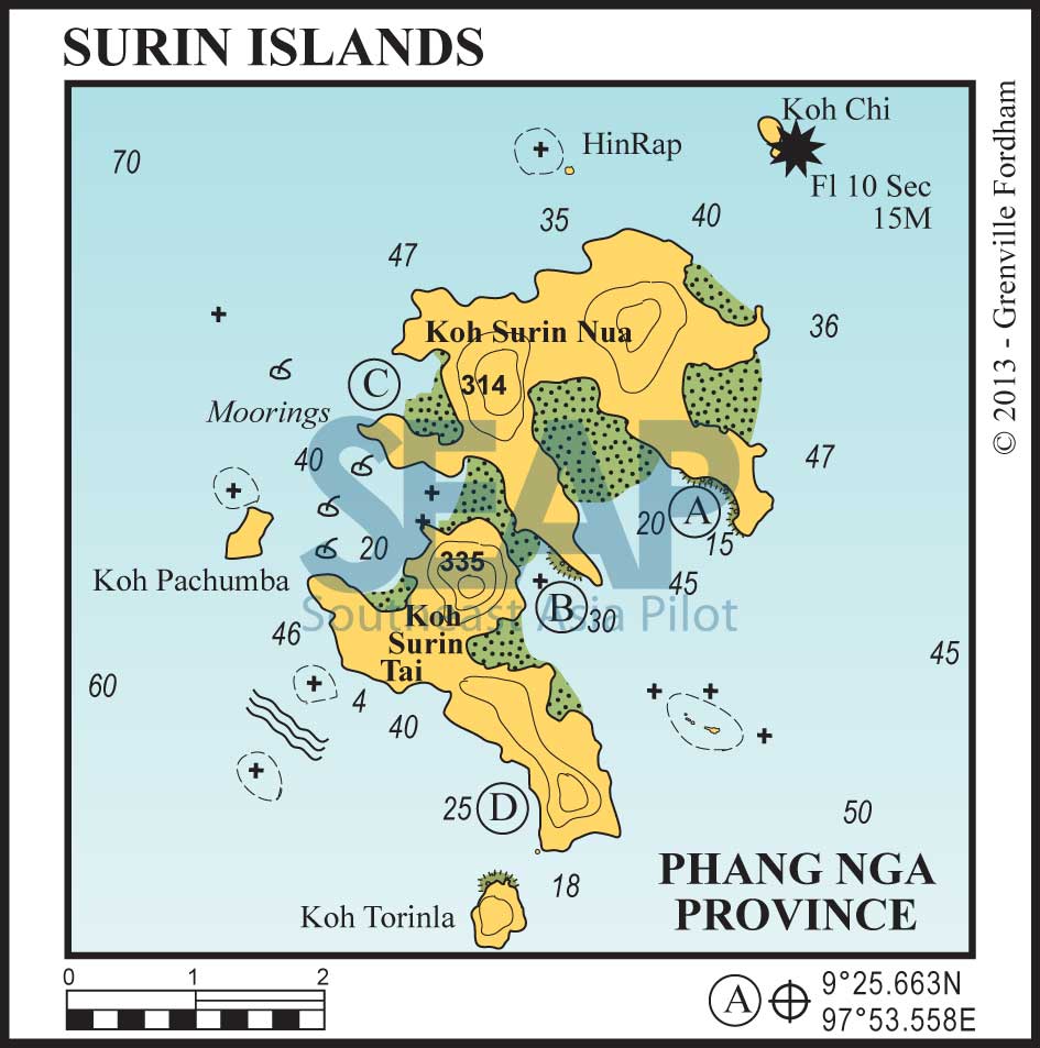
This marine national park is the Thai island group closest to Burmese waters. The Surins are uninhabited but for a few park rangers and the Singh (or Lion) Tribe of Chao Lay (sea gypsies), who have a settlement on Koh Surin Tai.
For cruising yachts these islands represent a much calmer environment than the Similans, as considerably less commercial diving boats frequent the anchorages. The same charges and regulations as in the Similans apply.
The Surins consist of two main islands with off-lying islets and rocks. Pretty coral and clear waters are of Similan standards, though the fish life is not as abundant.
Read more
9°21.9N, 98°1.25E
Located approximately 10 miles east of Koh Surin Tai, this famous pinnacle rock rising from a depth of 40 metres is a spectacular dive site. The largest fish in the world, whale sharks, are often spotted here in March and April.
Anchorage is not possible, but dive boat mooring buoys may be vacant if you’re lucky.
KOH SURIN NUA


Anchor on sand in 15-20 metres on the edge of the fringing reef. The bottom rises sharply from depths of more than 25 metres and the anchorage should be approached with care and a good lookout. There is good snorkelling off a fine beach backed by lush vegetation.
108 miles from Patong Bay


This anchorage, lying between the two islands on the northeastern side, provides a good overnight haven in the northeast season.
Anchor in 18 metres well out in the bay, avoiding coral on a sandy bottom. There are a few large moorings and a number of yacht moorings available to visitors at a small charge.
In the north of the bay, the park headquarters on Koh Surin Nua boasts a restaurant, showers and toilets and some bungalows. South of the bay, on Koh Surin Tai, a sandy spit with a spring at its northern end is accessible at high tide. The channel between the two islands is not navigable.
There is a daily ferry from Thap Lamu. The bay immediately north of the channel also has moorings but is not as convenient for the national park HQ.
108 miles from Patong Bay


This small secluded bay offers good protection in the northeast in 12-15 metres.
106 miles from Patong Bay


This is a great spot in heavy north easterlies. Approach the shore very carefully and anchor in 10-15 metres.
