

This section includes Fujian, China’s south-eastern province known for its mountains and coastal cities. Fujian faces the East China Sea to the east, the South China Sea to the south and the Taiwan Strait to the southeast. The coastline is rugged and has many bays and islands. Major islands include Quemoy (a.k.a. Kinmen), Haitan, Nanri and Meizhou, home of the goddess Matsu, the patron deity of Chinese sailors.
The port city of Xiamen, on the southeast coast of Fujian Province, is regarded as one of China’s cleanest and most beautiful cities, enjoying a mild climate. Xiamen has been the host to the China International Boat Show since 2008. www.xmboatshow.com
>>> Click here for a complete list of anchorages in Southeast Asia Pilot.
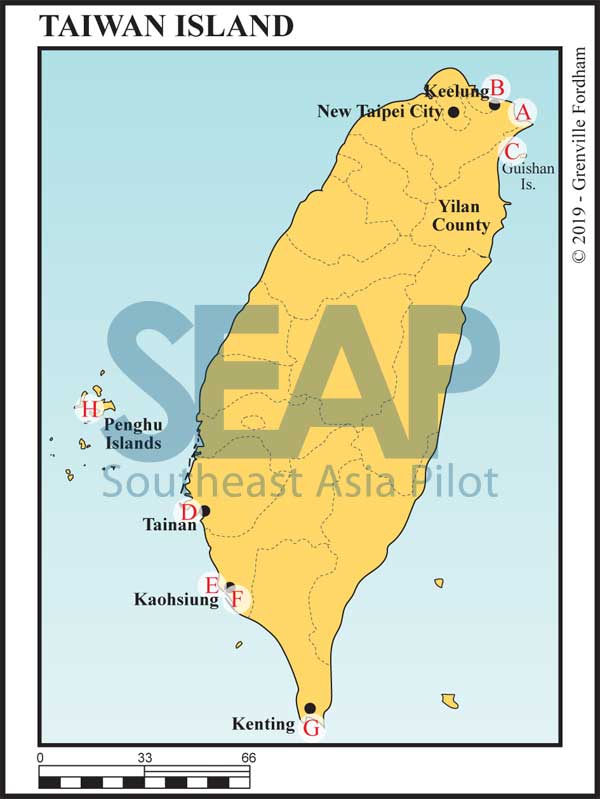
Leisure boating in Taiwan has only been possible since 2012, when the government opened territorial waters for recreational boating use. Yachting is gaining popularity in Taiwan. The government is encouraging the growth of the domestic boating market; it supported the first Taiwan International Boat Show in 2013 and abolished the luxury tax on yachts in 2014.
It is advisable to contact the port officials in advance at VHF Ch16 when nearing the Port of Entry. Upon entry, the skipper must tie up at the Port Security Dock, manned by the Taiwan Coast Guard. The marinas at Shaochuantou in Kaohsiung, Houbihu in Kenting, and Kang-tzuliao near Keelung have floating docks. Other marinas and ports have concrete quays.
After on-board inspection, the Coast Guard will summon the CIQ officers, who will meet you at the dock to process the documentation. Upon completion of the paperwork, you will be directed to an available dock in the harbour.
The typhoon season in Taiwan typically runs from July to September. The months with the highest number of rainy days are May and June. Forecasting is easily accessible and accurate. In addition to typhoons, earthquakes also occur in the region. Stay up-to-date with warning signs and track at www.cwb.gov.tw and www.twport.com.tw.
Taiwan has an active number of sailing organisations, including the Taiwan Yacht Sailing Association, Chinese Taipei Sailing Association and the Taipei Sailing Club
>>> Click here for a complete list of anchorages in Southeast Asia Pilot.
Keelung, Taiwan’s largest seaport is located in the northeast of the island is an official Port of Entry. Visiting yachts can make clearance in Keelung Port (25°9.442N, 121°46.375E). The Port Authority can be contacted at VHF Ch16. All authorities are based in the Customs building on the western side at the very end of the port, which has a concrete berth for yachts making clearance.
Keelung Port supposedly has a marina for visiting yachts, but its existence and/or location could not be confirmed at the time of publication. There are various options to tie alongside concrete docks. Upon clearance, visiting yachts may berth at nearby Longdong Yacht Harbor and Badouzi Starlight harbour.
This club is quite active, organizing events like Sailing-around-Taiwan-Island. Its sailing training base is at Yilan Wushi Yacht Harbour.

This section includes the Greater Bay Cities of Hong Kong S.A.R., Macau S.A.R., Zhongshan, Shenzhen, Zhuhai, Nansha, Dongguan, Guangzhou and Nansha. The Pearl River Delta features world-class marinas in Zhongshan, Nansha and Shenzhen, with Zhuhai up and coming.
The region is not open yet to free movement of yachts, but Macau S.A.R. and Guangdong Province are facilitating the first ‘free exercise’ movements of yachts. The Guangdong Yacht Tourism Association is an avid advocate to open up the Pearl River Delta for regional yachting.
>>> Click here for a complete list of anchorages in Southeast Asia Pilot.

Hainan Island, dubbed the “Hawaii of China” and host to world-class marinas, is the nation’s southernmost point. Located in the south China Sea, from Sanya Bay it is approximately 358nm southwest of Hong Kong and 150nm northeast of Danang. Hainan Island and the surrounding islands, coral islands, sandbanks and reefs make for attractive cruising. Hainan Island is a great jumping off point to visit the Paracel ‘Xisha’ Islands, a collection of reefs and atolls known for clean waters and marine life. Beware, though, that these islands are currently off-limits to foreign boats!
Known for its tropical and monsoonal climate, beach resorts, forested, mountainous interior and hilly hiking trails, Hainan Island has great beaches (Sanya Bay, Yalong Bay, Haitang Bay, Shimao Bay and Bo’ao). Sanya Bay was twice the only Asian stopover in the Volvo Round-the-World Yacht Race.
Rainfall is heavy during the monsoon season. Tropical storms and typhoons occur regularly in late summer and early fall. Forecasting is easily accessible and accurate. Stay up-to-date with weather warnings at www.cma.gov.cn. At the time of writing, we were unble to confirm the existence of official typhoon shelters. However, it is known that local fishing boats shelter in the harbour in Haikou, Hainan Province./
Foreign yachts visiting Hainan Island must deposit 40% of the yacht’s value. The Government of Hainan is deepening support for welcoming foreign yachts and is considering offering free guarantees to international visiting yachts at selected marinas, but at time of writing, the new laws had not been released. The Marina at Clearwater Bay can provide the guarantee for visiting superyachts through the Agile Group. Yachts that do not pay the guarantee can still make clearance but are not allowed to sail around Chinese waters.
Foreign yachts are allowed to berth at a limited number of marinas but must apply permission to berth in advance through Penavico (www.penavico.com.cn), the only authorised State Agency. Marinas will assist to forward the required documents as listed in the introduction of this chapter in advance (at least 3 working days are recommended). In addition, with the support of the provincial government, the time required to complete the immigration procedures has been significantly reduced. Authorised foreign yachts may remain in the area up to 183 days per year.
>>> Click here for a complete list of anchorages in Southeast Asia Pilot.

This chapter covers Macau, which became a Special Administrative Region (S.A.R) of China in 1999. Macau S.A.R. consists of the Macau Peninsula, Taipa Island and Coloane Island, as well as Cotai, a strip of newly reclaimed land between the two islands. Since 2018, Macau S.A.R. is connected with Hong Kong S.A.R. via the Hong Kong-Zhuhai-Macau Bridge, a 55-km long bridge-tunnel system.
Macau is not noted for being a spectacular cruising destination, but it has a small boat population, currently in one marina only, with three new marinas being developed. Most sailing is based around weekend harbour cruising. In addition, the Macau Sailing Association is active at Hac Sá Beach in Coloane, mostly dinghy sailing.
Skippers of overseas yachts must submit their application to the Marine and Water Bureau prior to arrival. Please visit the ‘Services’ section of www.marine.gov.mo for the ‘Application for Port Call for Non-Macao Registered Pleasure Boats’. This form must be submitted together with crew list, port clearance form, berthing certificate (provided by the yacht club), Macau insurance, certificate of ownership and operating license.
T. +853 8988 2101 / +853 8988 2571 | E. info@marine.gov.mo
Upon arrival at the marina in Macau, the skipper must call the immigration department at +853 8798 5327 and request for immigration clearance. A police officer will come to the marina to give arrival clearance for skipper and crew. The procedure for departure is identical.
The typhoon season in Macau typically runs from July to September. Forecasting is easily accessible and accurate. Stay up-to-date with warnings and track at www.smg.gov.mo. Unlike Hong Kong S.A.R., there are no officially designated typhoon shelters.
>>> Click here for a complete list of anchorages in Southeast Asia Pilot.

On entering Cairns Shipping Channel, contact Cairns Harbour Control on VHF Ch16 to give an ETA. Yachts are usually told to proceed to the Marlin Marina. If everything is in order, clearance there is efficient, quick friendly and helpful. Australian Quarantine and Inspection Service : Tel +61 7 4030 7800.
TEXTAAC Building, Cairns International Airport, QLD 4870
Tel +61 7 4052 3526/after hours 0419 778 990, VHF Ch16 CairnsShipping@customs.gov.au Boarding Station for arrival “A” finger, Marlin Marina.
Port of Cairns is a Queensland regional port that caters to a diverse range of vessels from bulk and general cargo, cruise shipping, super yachts, cruising yachts, fishing fleet and reef passenger ferries.
Cairns is a gateway to wonderful reef and island cluster cruising destinations for international cruise ships, transient superyachts and a number of domestic cruise vessels operating out of Cairns.
Sailfish Quay, a finger inside Marlin Marina provides world-class super yacht berths for vessels up to 140m.
Cairns Port offers extensive and professional ship building and repair services with a number of slipways and dry docks up to 3,000 ton capacity for a diverse range of ship maintenance requirements. Every possible yacht or boat service is available in Cairns.

>>> Click here for a complete list of anchorages in Southeast Asia Pilot.
Formerly the Anglo-French ‘condominium’ New Hebrides, Vanuatu gained independence in 1980. The country comprises 13 main and many smaller islands, stretching 650 kilometres from north to south. The capital is Port-Vila on the island of Éfaté.
Vanuatu’s population, called ni-Vanuatu (often shortened to ‘Nivan’), is mostly Melanesian. While the majority live in the countryside working the land, there has been a move since independence to the urban centres of Port-Vila and Luganville. The official national language is Bislama, but there more than 100 Melanesian dialects in use; French and English are also accorded ‘official language’ status.
elatively unspoiled outside the main centres, sub-triopical Vanuatu’s unspoiled islands await the adventurous cruiser.

>>> Click here for a complete list of anchorages in Southeast Asia Pilot.

Solomon Islands is a nation state made up of six main islands and over 900 smaller islands, covering 28,400 sq km between latitudes 5°-13°S, and longitudes 155°-69°E. The capital, Honiara, is on the island of Guadalcanal.
A former British protectorate that gained independence in 1978, the Solomon Islands population is predominantly Melanesian and the official language English. However, only a tiny percentage of the population is able to use English fluently, the de facto main language being Solomons Pijin. Nevertheless, there are at least 70 languages and dialects in use throughout the islands.
The islands played a significant part in World War II, and the Battle of Guadalcanal has become entrenched in military folklore and has featured in numerous movies.
On another note, Solomon Islands has one of the highest rates in the world of GBV (Gender Based Violence), with 73% of men AND 73% of women considering violence against women justifiable for disobedience…
Honiara is the capital city of Solomon Islands and is an official port of entry. Anchoring or stopping before you clear in at an official port of entry can result in heavy fines. We highly recommend using an agent in Solomon Islands; it’s well worth the extra expense saving you time and the aggravation of navigating the local bureaucracy.
Theft from yachts can be a problem, especially around Honiara and Gizo. Take sensible precautions. However, yachts (and the money they bring to spend in the villages) are generally welcomed and most locals are keen to help if you get into trouble.

>>> Click here for a complete list of anchorages in Southeast Asia Pilot.

Fifteen miles offshore are the dozen islands of the Koh Rong Group. Koh Rong is the second largest in the country behind Koh Kong at the Thai border. The main island has four small villages: Koh Tuich, Dam Dkeuw, Prek Svay and Soksan. There are more than 15 guesthouses and bungalows on Koh Rong and smaller Koh Rong Samloem, many of them foreign owned.
These islands are earmarked for high-end, environmentally planned, resort development. The Royal Group, headed by Kith Meng, has been granted a 99-year lease by the government to develop the main islands and they have already begun construction of the main north-south road and electrical infrastructures.
Koh Rong is already setting the benchmark for luxury tourism with the recent opening of Song Saa Private Island on a pair of islets in the northeast bay. Song Saa means ‘Darling’ in Khmer.
The east and west coasts of both islands offer plenty of year-round anchorage opportunities in the many sheltered beaches and bays. Forbes Magazine recently rated the pearl-white sand beaches of Koh Rong as some of the best in Asia. Certainly the three-mile powder white sand beach on the west coast of the main island rivals the best in Thailand.
South China Sea water clarity cannot compete with the fast-recycling Andaman Sea, but around Koh Rong the visibility runs up to 10 metres with plenty of healthy coral and abundant tropical marine life.

>>> Click here for a complete list of anchorages in Southeast Asia Pilot.
At the time of writing the town of Sihanoukville was an uncontrolled and unmanageable building site with roads destroyed and traffic backed up for miles.
The onslaught of mainland Chinese casino investment projects has overwhelmed the city and its once glorious beaches. The International Airport and advent of direct international flights has turned this once sleepy fishing village into flashing-lights Las Vegas of the east.
The provincial capital is a sprawling concrete high-rise mess over the top of Victory Hill down into Kampong Saom commercial port to the north. The tourist beaches run to the south and north from the Golden Lion five-way roundabout.
There are currently sixty or more Chinese casino resorts operating in Sihanoukville with dozens more in the pipeline. You could be forgiven for thinking the entire area was a casino province of China.
The capital Phnom Penh is only 200 kilometres north, but the journey can take up to four hours by bus or private taxi due to the sometimes-poor condition of the two-lane highway. It’s worth the ride to get an idea of the country and its people.

We mention only a few of our favourite anchoring spots, but it’s possible to anchor anywhere in a comfortable depth off the several beaches all separated by rocky headlands.
The main tourist beaches are lined with thatch-roofed shacks offering cold drinks, umbrellas and chairs, BBQ seafood, evening parties and water sports. However, recently many have been cleared and roads diverted to make way for the high-rise developments going in at a rapid pace.
US dollars are king in this casino town and it’s best to convert whatever currency you have into dollars prior to arrival. The exchange rates are unpredictable − except for the US$. At the time of writing 1 US$ was equal to just over 4000 Riel.
Sihanoukville is currently exploding onto the beach ‘Casino Capital’ of the South China Sea. As always, the young backpacker crowds, having forged the way are fast being forced out to find cheaper, more environmentally sensitive, spots.
Cruise ships already stop by at the port, albeit infrequently, during their voyages in Southeast Asia. Other private casino ships, serviced by daily ferry and wildly adorned, are permanently moored just offshore near Koh Pous. These vessels are regionally known as “Cruise to Nowhere” casino operations.
")
>>> Click here for a complete list of anchorages in Southeast Asia Pilot.
To the north is the famous and unbelievable all-year playground of Van Phong Bay. A large, deep inland-sea area protected by two outer islands and the 17-kilometre sand dune, with many channels and inlets to explore.
It is home to hundreds of fish and pearl farms. The fish farms tend to get moved around on a seasonal basis; what might be a nice quiet bay one week can be home to several farms the following week.
It is an excellent area to explore and find your own quiet anchorages. The huge sand dune that forms the northern end of the bay is also accessible by yacht. Although there are a few shallow spots, generally the water right up to the dune is 10-15 metres deep.

>>> Click here for a complete list of anchorages in Southeast Asia Pilot.
This large bay on the mainland is mostly shallow. Our only recommended anchorages are at the mouth of the bay or on the small island further south.

>>> Click here for a complete list of anchorages in Southeast Asia Pilot.
Nha Trang in Khanh Hoa Province is a major port on the east coast of Vietnam. The town itself is considered Vietnam’s most charming, being in the old French colonial heartland. Just offshore is the Hon Tre group of islands where there are some excellent anchorages, great scenery, good snorkelling and diving and good beaches.

12°22.16N, 109°12.74E
Hon Lao is close to the mainland and is famous for its 1,000 or so resident monkeys that are accustomed to food handouts from visitors. Bear in mind that these are wild animals and that monkey bites are a potential source of rabies. There are also monkey, elephant and dog shows, as well as ostrich rides, all best avoided for obvious reasons.
There is plenty to see and do ashore, including paintball games, kayaking or just relaxing on the beaches.
Anchor on the west side of this small island in 2-4 metres to shelter from the southeasterly swell. Best to head toward the large green Chinese Pagoda on the shore, which will lead you away from low ground immediately west of the island.

>>> Click here for a complete list of anchorages in Southeast Asia Pilot.
Palawan is the 270 mile long island west of the Sulu Sea and is world renowned for the quality of the diving on the west coast. The north western side of the island is indented with many deep natural bays and opportunities to anchor are numerous.
In the northwest there is an airport at El Nido, which has become the main popular tourist and diving destination. Restaurants, accommodation and provisioning, including fuel, are all available − but at much higher prices than in Manila.There are also small airports in the far south but this region is less developed.
Puerta Princesa, located in the middle of the island on the east coast, is the main city and is served by an international airport and ferry links to other islands.
These Palawan notes have been kindly provided by Terry Sergeant, Morgan Hayes and Mark Holroyd.

>>> Click here for a complete list of anchorages in Southeast Asia Pilot.

>>> Click here for a complete list of anchorages in Southeast Asia Pilot.


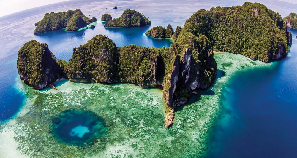
A combination of captivating scenery, outstanding diving and exuberant nature has made Raja Ampat an increasingly popular destination amongst cruisers in the past decade.
Its name translates as “The Four Kings” in Bahasa Indonesia, referring to the four main islands of Waigeo, Batanta, Salawati and Misool. Myriad smaller limestone karst spires − similar to those found in Thailand’s Phang Nga Bay or Palau − lay scattered around the major ones, all together hosting vast expanses of mangroves, powder white sand beaches and lush tropical reefs. It’s also a cetacean thoroughfare, with several species of whales and dolphins being commonly spotted in its waters.

The Four Kings (AKA R4) cover an area of 50,000 square kilometres and have mountainous interiors, with the highest peaks reaching 1,000 metres in North Waigeo and Batanta.
Conveniently positioned at the threshold of the Pacific and straddling the equator, Raja Ampat lays at the western end of West Papua, Indonesia’s 26th province, widely known as the Bird’s Head Peninsula because of its shape. Just outside the western tip (right by the ‘beak’) is Sorong, the main port of entry.
The town has all the basic facilities to supply any visiting vessel and the closest airport to Raja Ampat with several daily flights connecting to other parts of Indonesia.
Raja Ampat remains sparsely populated, with the majority of its 35,000 inhabitants distributed amongst less than a hundred villages. They are mostly located around the coast in houses built on stilts over the reefs and beaches.
Descendants of intermarriages between Papuans and Indonesians, and with marked Melanesian features, the people here live in a subsistence economy based on a fish-protein diet, taro (the main staple food made from a root starch) and a few fruits and vegetables. Copra (dry coconut flesh) is also a common product.
The entire area is becoming increasingly popular with each year’s season heralding the opening of new resorts and homestays for international visitors. More new and restored Phinisi liveaboard dive vessels arrive to operate commercially year round or seasonally charter during the best-weather months.
Apart from diving there are reasonable surf breaks on the north coast of Waigeo, many scenic spots for kayaking and interesting land tours, including short hikes to view birds of paradise, which are endemic to the area.
The equatorial climate of Raja Ampat is hot and humid all year around. The best time to visit is from October to May, during the northwest monsoon, when the winds tend to be less severe. Because of this, many of our favourite anchorages are on the south side of the islands.
The dry season from June to September is less popular and typified by strong southerlies. Tropical rains are fairly common throughout the year, generally short-lived heavy showers followed by long sunny periods. Longer ground swells rolling down from the west Pacific are common in the northern region, around Wayag, Kawe and north Waigeo.
Most of the best diving anchorages are deep and exposed to at least one quadrant. All visiting yachts should be prepared to anchor in 40-50 metres well outside the fast-rising fringing reef edge. The local government requests that all vessels anchor in no less than 40 metres and at least 300 metres away from the more popular dive spots.
Moorings have been laid at some diving spots and can usually accommodate vessels up to the same tonnage as the liveaboard dive boats in the area. If occupied it usually means divers are down in the immediate vicinity so exercise care and keep a watch for bubbles. In light conditions it’s acceptable to ask if you can tie up to the stern of a dive vessel already on the mooring.
In an effort to protect the delicate underwater ecosystem, the local government has designated seven Marine Protected Areas (MPAs) within the region. Vessels must obtain a special permit before entering any of these protected areas. Click here for details of these areas.
Permits are issued at the Raja Ampat Conservation & Tourism Information Centre at Waisai on Pulau Waigeo. In addition to the vessel fee every foreign visitor must pay an individual ‘tag fee’ of (at the time of writing) Indonesian RP1,000,000 (Indonesian nationals RP500,000) . This Marine Park Entry Tag or PIN has been recently increased and renamed the ‘Tariff to Support Environmental Services in Raja Ampat’. These tags are waterproof plastic meant to be carried at all times even on dive tenders. There are issued for one year period.
This ‘Tag’ or ‘PIN’ costs (at the time of writing) RP1,000,000 (US$77 approx) per visitor and is levied to help the locals manage environmental impact. It’s a plastic card that’s good for a year from the date of purchase.
It’s been reported that government officers at some anchorages may want to check each passenger’s tag and see the paid receipt. For superyachts, agents usually arrange tags in advance of arrival. Some resorts (Hotel Je Meredien Sorong is one) will pre-purchase them on behalf of their guests but most homestays in Sorong and Waisai don’t yet offer this service.
Away from Sorong be wary of individuals claiming to have the rights to sell them to you. For private vessels there were only three authorised distributors at the time of writing:
♦ In Sorong, The Raja Ampat Conservation & Tourism Information Centre is directly opposite the airport access road.
♦ At Waisai town on south Pulau Waigeo, the Tourist Information Centre at the ferry port
♦ Further inland at the Tourism UPTD KKPD office, a short drive away. Keep the receipts and don’t cruise in the area without them.
>>> Click here for a complete list of anchorages in Southeast Asia Pilot.

Sumatra is the westernmost of the Sunda Islands and is the largest island entirely Indonesian governed. The larger island, Kalimantan, is shared between Malaysia, Brunei and Indonesia. Sumatra is the world’s sixth largest island with a population of over 50 million. The capital is Medan on the northeastern coast in the Malacca Straits.
Sumatra’s Indian Ocean west coast has the famous surfing island groups of Simeulue, Nias and Mentawai. The northeast coast forms the narrow Malacca Strait with the Malay Peninsular and the southeastern Sunda Strait separates her from Java.
On the lower eastern side are the islands of Bangka and Belitung and the Karimata Strait in the Java Sea. The equator crosses the centre of the island giving the land mass a hot humid climate where tropical rain forests dominate the landscape.
The Great Sumatran fault runs down the entire west coast of the island. On 26 December 2004, the Indo-Australian plate slid under the Eurasian plate causing the devastating Boxing Day tsunami. More than 170,000 Indonesians were killed, primarily in the northeastern Aceh province.
We mention only a few of the many anchorages on offer here and welcome comments, suggestions and notes from cruising yachtsmen for the next edition. Email us at: feedback@southeastasiapilot.com
The famous Sunda Strait stretches in a north-east/south-west orientation, with a minimum width of 16 miles at its north-eastern end between, Cape Tua on Sumatra and Cape Pujat on Java.
It is very deep in the west, getting shallower to the east as it narrows. Cross currents and wind against tide make it sometimes notoriously difficult to navigate.
The strait is dotted with a dozen islands, many offering temporary shelter. Half are volcanic in origin, the best known being the famed Krakatoa. In 1883 it exploded killing 36,000 people and destroying most of the island. The blasts are the loudest recorded in modern history, heard some 5,000 kilometres from the origin. Recently the Krakatoa volcano has re-emerged from the ocean and is the principle upward force in the formation of a brand new island, Anak Krakatoa, or ‘Child of Krakatoa’.
An accord was signed in 2012 with the China Railway Construction Corporation to build a road with a double track rail suspension bridge, utilising the islands of Ular, Sangiang and Prajurit. It would have been 70 metres above sea level with a maximum span of three kilometres, making it nearly fifty percent longer than the current world record holder.
However, in November 2014, the incoming government abandoned plans for the bridge, preferring to improve maritime resources such as more passenger and freight vessels and improved port facilities.
The decision to shelve the bridge plans was more than vindicated when, in December 2018, Anak Krakatoa erupted causing a tsunami that killed more than 400, making it the most deadly volcanic eruption this century.
After having lost over two thirds of its volume following the eruption, the volcano has continued evolving. As recently as May 2019, a new crater was observed and the volcano’s volume continues to increase.

Go back to main Sailing & Exploring in Indonesia page
>>> Click here for a complete list of anchorages in Southeast Asia Pilot.

This massive region from the 3rd parallel south to the 5th parallel north encompasses some of the most fascinating cruising grounds on offer in Indonesia if not the world.
Running west from Chandrawih Bay on north Papua, the Indonesian equatorial region includes the incredible Raja Ampat group, the stark island of Halmahera and northern Sulawasi.
As with all equatorial regions, the weather is hot and mostly wet with some dry calm and windless doldrums days in the better cruising months of November to March.
Rule of thumb on the Equator: it’s either raining or it’s about to rain…
>>> Click here for a complete list of anchorages in Southeast Asia Pilot.
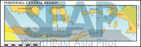
The central region lies generally between the 3rd and 7th parallels. This region contains the historically significant Spice Islands of the Banda Sea and the lesser-known Kai, Wakatobie and Gorong groups. Further east is central Papua, home of the fantastic Asmat coastal tribes.
Cruising west from Ambon are the Selayar group of southern Sulawasi, Bira the home of traditional wooden boat building, Makassa the ancient sea port and the entire south coast of Southern Kalimantan. Again we only list a few of our favourite stops amongst the many hundreds of anchorages on offer here.
South Papua’s coast is vast low, flat land as opposed to the mountainous rain forests of the remaining interior of the province.
This coastal region is home to the Asmat tribes, who fiercely hold onto their traditional culture. They have been able to do so because much of this area is phenomenally remote and completely unexplored. Its massive size and inhospitable boggy landscape dictate that its primitive semi-nomadic peoples depend entirely on vast networks of rivers and creeks for food and transport.
Until recently headhunting was the norm for avenging the death of a family member. Strong and dignified, the Asmat peoples accept visitors entirely on their own terms. The livelihoods in this region are fishing and farming as opposed to the multinational mining and logging in the interior mountains.

>>> Click here for a complete list of anchorages in Southeast Asia Pilot.
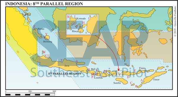
This route is the traditional journey from Australia in the east or Singapore to the north. En route are the Komodo Islands, famous for their dragons, and Bali, Hindu island of the Gods.
The sheer distances involved mean there are well over 300 available small yacht anchorages in and around these islands. We list only a few of our own sheltered favourites – and welcome new information and vital feedback from traveling yachts as we continue to update the best spots to stop on this journey.
>>> Click here for a complete list of anchorages in Southeast Asia Pilot.
Darwin is a major support centre for commercial prawn and fishing industries, and a hub for oil, gas and mining. The Australian Navy has its northern patrol boat fleet stationed here. As a result it’s an excellent place for cruising yachts to stop for repairs and maintenance. All the major engine and yacht equipment suppliers have shops and service centres here.

All vessels over 25 metres entering Darwin Harbour limits must have a pilot on board. It doesn’t matter whether you’re a commercial or private vessel. Every marina demands comprehensive paperwork and vessel insurance in place before they’ll let you into their locks. Start a conversation in advance and email a copy of your insurance to avoid the irritation of waiting on anchor out in the roads.
Darwin is a major support centre for commercial prawn and fishing industries, and a hub for oil, gas and mining. The Australian Navy has its northern patrol boat fleet stationed here. As a result it’s an excellent place for cruising yachts to stop for repairs and maintenance. All the major engine and yacht equipment suppliers have shops and service centres here.
All vessels over 25 metres entering Darwin Harbour limits must have a pilot on board. It doesn’t matter whether you’re a commercial or private vessel. Every marina demands comprehensive paperwork and vessel insurance in place before they’ll let you into their locks. Start a conversation in advance and email a copy of your insurance to avoid the irritation of waiting on anchor out in the roads.
It can be difficult to secure a berth in one of the four Darwin marinas, all accessed via locks due to the tidal range. In the dry season from April to October, marina berths are hard to come by, so book in advance. July is the most difficult month due to the influx of visiting yachts joining the ‘Sail Indonesia Rally’ and the ‘Darwin to Ambon Yacht Race and Rally’.
There are three main routes from Darwin to Singapore. The first is checking in at Kupang, West Timor then leaving Savu and Sumba to the south, crossing through the island chain via the Komodo Strait. A westerly route then follows to the north of Sumbawa, Lombok, Bali, Java and north to Singapore.
Alternatively, leaving Darwin and laying a course for the Northern tip of East Timor before turning west to follow the northern reaches of Alor and Flores joining the same route north of Sumbawa. It is possible to use any of the straits between the Indonesian Islands to traverse from the Indian Ocean to the Flores Sea, but particularly the Lombok and Alas Straits have significant current and tidal races. The rule of thumb is it floods to the north and ebbs to the south.
For those not wishing to check into Indonesia, the best route is west to Christmas Island (which is Australian territory) some 1,600 miles from Darwin, then north to the Sunda Strait past Krakatoa and onward to Singapore.
Prior to Covid-19, there were three yacht races and rallies organised from Darwin into Indonesian ports. It remains to be seen what reemerges once the pandemic has receded. It is commonplace for yachts to join these events because they offer a security clearance and mass check-in facilities, including immigration clearance and cruising permits for Indonesia.
>>> Click here for a complete list of anchorages in Southeast Asia Pilot.

Lying to the east of Peninsular Malaysia is the island of Borneo. On the northwest side of this huge island are the two East Malaysian states of Sarawak and Sabah, with the independent state of Brunei nestled between them.
The remainder of the island is Indonesian Kalimantan. Sarawak is home to many indigenous hill tribes still living in traditional stilted houses on the riversides – who were still headhunting as recently as during WWII. Sabah is the more mountainous of the two states, and boasts Mount Kinabalu, at 4,100 metres the highest mountain in Southeast Asia.
Read moreClick to view Malaysia photo gallery.
>>> Click here for a complete list of anchorages in Southeast Asia Pilot.

Yachts heading up the east coast of Peninsular Malaysia, or on to the Gulf of Thailand, may enter Malaysia at Tanjung Belungkor Ferry Terminal or Tanjung Pengelih at Pengerang. Both are tucked behind the reclaimed island of Pulau Tekong off Singapore’s northeast corner. Opportunities to check in further up the Malaysian coast are located at Kuantan, Kuala Terengganu and Kota Bharu.

Just 30 miles from Singapore, on the southeast coast of Johor, lies the 3,800 acre Desaru Coast Integrated Resort Development. This government-linked mega-project has 17 km of oceanfront, Ernie Els club golf courses, the massive Adventure Water Park with a 4-metre high wave pool, Hard Rock Hotel, Westin Resort, Anantara Resort and a One and Only Resort. There is the River Walk Retail and Entertainment Boulevard and several other recreational and tourist offerings in Phase 1 of this project.
Read moreTioman is the largest island of the 64 in the Seri Buat group – with some beautiful beaches and a 1,000-metre mountain at its centre – and is close enough to Singapore to have developed a number of good quality resorts. This was the location for the old classic film ‘South Pacific’ and more recently ‘King Kong II’.
The next section can be a schlep up the Malaysian coast. It’s mostly uninviting, offering only small river ports.
Terengganu is the last CIQ opportunity on this coast to officially check out of Malaysia.
Read more>>> Click here for a complete list of anchorages in Southeast Asia Pilot.

The Malacca Straits is one of the most important shipping lanes in the world. The southern entrance starts just north of Singapore and connects the Pacific and Indian Oceans. Over 100,000 ships trading almost half the world’s seaborne trade pass through this narrow 450-mile thoroughfare every year. With so much commercial traffic, best to stay well clear of the Traffic Separation Scheme (TSS), strictly adhere to COLREGS and keep a proper watch day and night.
Navigation is not difficult with only a few shallow areas, which are well buoyed and lit. Southeast of the TSS watch out for floating debris, numerous fishing buoys, bamboo structures and gill nets on the shallower banks. At night floating nets are lit with flashing red strobes so maintain watch and the ability to manoeuvre quickly. Once a gill net is tangled up around a prop or rudder, complete removal sometimes means going overboard with a sharp knife.
Read more>>> Click here for a complete list of anchorages in Southeast Asia Pilot.

Pattaya is 147 km southeast of Bangkok and faces the Gulf of Thailand. The only place of note between Bangkok and Pattaya is a small marina in a housing project in the Bang Pakong River.
The coast southeast from Pattaya to the Cambodian border has many relatively undeveloped islands, but for the moment there is only one really safe year-round haven for yachts along this coast, Ocean Marina just south of Pattaya.

There is also a good natural harbour at Sattahip, but this is used by the Royal Thai Navy and is out of bounds.
Read more>>> Click here for a complete list of anchorages in Southeast Asia Pilot.

North of the Malaysian border, the first main Thai ports are Narathiwat and Pattani, both commercial fishing harbours. Not usually on the itinerary of cruising yachts, they can be entered through well-buoyed channels.
Read moreThe port of Songkhla lies at the mouth of an inland waterway ad is the best first point of entry into Thai waters. A large commercial port, at the mouth of the river services the supply vessels for the offshore rigs to the east.
Read more
The city of Surat Thani is the capital of the province of the same name and means ‘City of the Good’. The main town is nestled close to the coast facing northeast at the mouth of the Ta Pi River. The city fringes the huge bay of Ao Ban Don which is shallow, lacklustre and uninviting.
Read moreThis section covers the area bounded by Koh Tao, the Ang Thong National Park group, Koh Phangan, Koh Samui to the east, and Chumpon to the west.
Read more>>> Click here for a complete list of anchorages in Southeast Asia Pilot.

From Koh Lanta to Tarutao covers 110 miles of coastline and islands, encompassing the three mainland provinces of Krabi, Trang and Satun at the Malaysian border. It includes Hat Chao Mai National Park, which covers 360 square kilometres and takes in 52 islands.
This area is popular for yachts travelling between Langkawi and Phuket − and has been a regular run for non-Thai registered yachts checking out of Thailand every six months. (New regulations announced in March 2021 mean the days of 6-monthly yacht ‘visa runs’ are over. Visiting yachts can now stay in Thailand up to 30 months.)
Read more
>>> Click here for a complete list of anchorages in Southeast Asia Pilot.

This chapter covers the two degrees of latitude on the Thai coast from just south of Phuket to the border town of Ranong in the north. It encompasses the four west coast provinces of Phuket, Phang Nga, Takua Pa and Ranong. Many diving companies use the port of Thap Lamu to service the offshore islands of the Similans and Surin. Ranong Town is the gateway to the Mergui Archipelago.

The west coast of Phuket offers some of the clearest water and most beautiful beaches in the region. Consequently, here you find the biggest concentration of hotels and beachside activity in the Andaman Sea. The advantages to any visiting yacht are obvious. But the lure of restaurants, nightlife, shopping, etc. may be offset by the buzzing jet skis and ski boats.
Read more>>> Click here for a complete list of anchorages in Southeast Asia Pilot.
Click to view Krabi & Phi Phi photo gallery.

The stunning beach and sea-mountain scenery of Krabi is famous with many visitors extolling some of the beaches here as amongst the most beautiful in the world.
This is a geographic extension of the karst sea-mountains of Phang Nga, reaching south into deeper, clearer waters and thus offering fine snorkelling and diving. In the northeast monsoon season anchorages here are protected, though the region is completely exposed during the southwest monsoon.
Read more>>> Click here for a complete list of anchorages in Southeast Asia Pilot.
Click to view Phang Nga Bay photo gallery.

The area bounded by Phuket, Phang Nga and Krabi provinces forms Phang Nga Bay. There are over 100 islands, and the geology varies from low gently sloping mountains to the steep karst outcrops for which the bay is most famous.
At the south end of Phuket is a large protected bay, Ao Chalong, which is the usual port of entry into this region and where the main port control centre is located. In this chapter we list anchorages from Ao Chalong (southeast Phuket) all the way to Yacht Haven Marina (northeast Phuket).

>>> Click here for a complete list of anchorages in Southeast Asia Pilot.

This chapter covers Hong Kong Island and what were formerly the New Territories before Hong Kong became a special administrative region of China in 1997. In all, there are over 200 islands, many uninhabited, scattered around the densely populated Hong Kong Island and Kowloon.
Nevertheless, the area is not noted for being a particularly spectacular cruising destination, but it does have a large boat population in many marinas and is an excellent centre for marine services and supplies. Most of the sailing activity is based around weekend racing and harbour cruising.
Hong Kong is well known for typhoons. Despite this, there has always been massive boating activity. The scattering of smaller islands results in many sheltered coves and anchorages, which are designated as typhoon shelters. Weather forecasting is easily accessible and accurate. Stay up-to-date with actual warning signs and track at www.hko.gov.hk.
Skippers of overseas yachts must submit their application to the Marine Department prior to arrival. Please visit the ‘Port Services’ section of the website for the requirements, procedures and forms. T. +852 2542 3711 mdenquiry@mardep.gov.hk www.mardep.gov.hk
Upon arrival in Hong Kong, the skipper is required to complete port formalities with the Department of Health, Immigration Department, Marine Department and Customs and Excise Department.
There are a number of designated typhoon shelters, some of which are listed below.
Aberdeen Harbour 22°15N, 114°09E
Rambler Channel 22°21.4N, 114°06.8E
Yim Tin Tsai 22°22.7N, 114°18.5E
Taipo Boat Club 22°26N, 114°13E
Hei Ling Chau 22°15N, 114°02E
Castle Peak Bay 22°22.6N, 113°58.4E
>>> Click here for a complete list of anchorages in Southeast Asia Pilot.


